Editor’s Note: GIS & You is publishing two companion articles describing a project to create a physical 3D model of King County. Each article is written from the perspective of one of the two analysts who worked through the process to make the model a reality. Please see the accompanying article titled “Converting digital terrain data into a 3D printed model of King County” for a more complete picture of this complex effort.
As the most-used GIS packages, ArcGIS and QGIS are amazing and powerful for analytical applications. Despite their analytical strengths, they sometimes don’t quite achieve the quality needed for high-level graphics. It’s common for cartographers to prepare maps or layers of maps in ArcGIS, then export them for use in Adobe Photoshop or Illustrator where more sophisticated graphic techniques can be applied to create finished map products. The King County GIS Center recently came across another need to go beyond the graphic capabilities of ArcGIS.
At the KCGIS Center, we provide a variety of geospatial mapping and analyses to internal and external clients. Recently, the King County Office of Emergency Management asked us to create a physical topographic model of the county with an aerial photo applied. In a purely digital format, this is a simple task. With our ArcGIS 3D modeling software, ArcScene, you can easily take a digital elevation model or other 3D format and visualize it on your screen. Draping aerial photos, 3D building models, or other geographic data on top is an easy process. Getting it into a format that could be translated into a physical object turned out to be more complex.
To create the model, we decided on a 3D printing process. The KCGIS Center engaged the digital manufacturing company FATHOM to produce the work—a plastic 3D model printed with an aerial photo draped over the topography. The 3D printer required a file type, OBJ, that is not supported by ArcScene so we needed to find a method to translate our GIS data formats into the OBJ format.
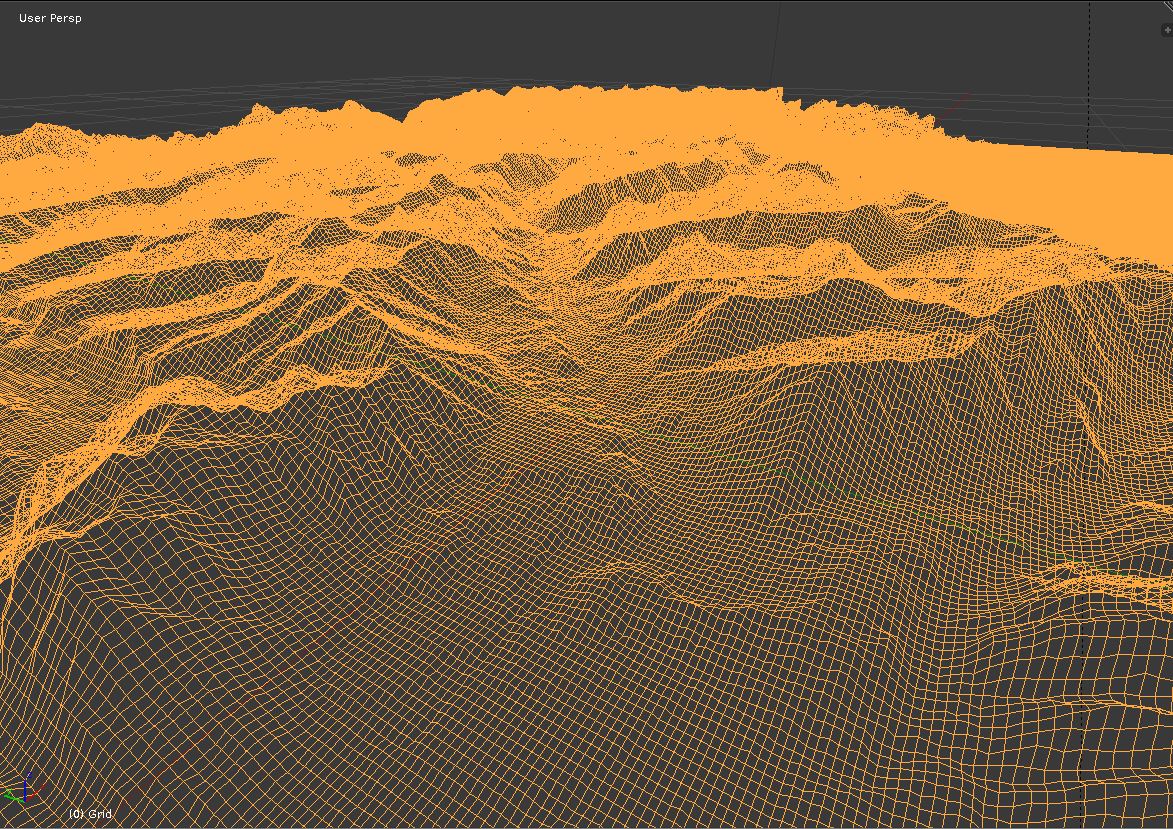
3D mesh in Blender 
Blender terrain model with aerial photo
We found a solution in Blender, an open-source application for 3D modeling and animation. While not GIS-specific software, Blender has become a valuable raster elevation tool for many cartographers. Its rendering technique, ray tracing, is more graphically sophisticated than what is used in typical GIS software. Hillshades rendered with Blender can be easier to read and understand than those from ArcGIS or QGIS. In areas of varied terrain, Blender hillshades feature subtle shadows, crisp ridge lines, and smooth valley floors. It can also create realistic global maps with clouds and atmospheric effects. For our project, we used it to create a 3D mesh from an elevation model of the county, applied an aerial photo to the model, and exported the result to the OBJ file format that could be used to generate a printed 3D model.
FATHOM delivered the 38×27-inch printed 3D model to Emergency Management and it is being used by them to organize and plan for disaster response.
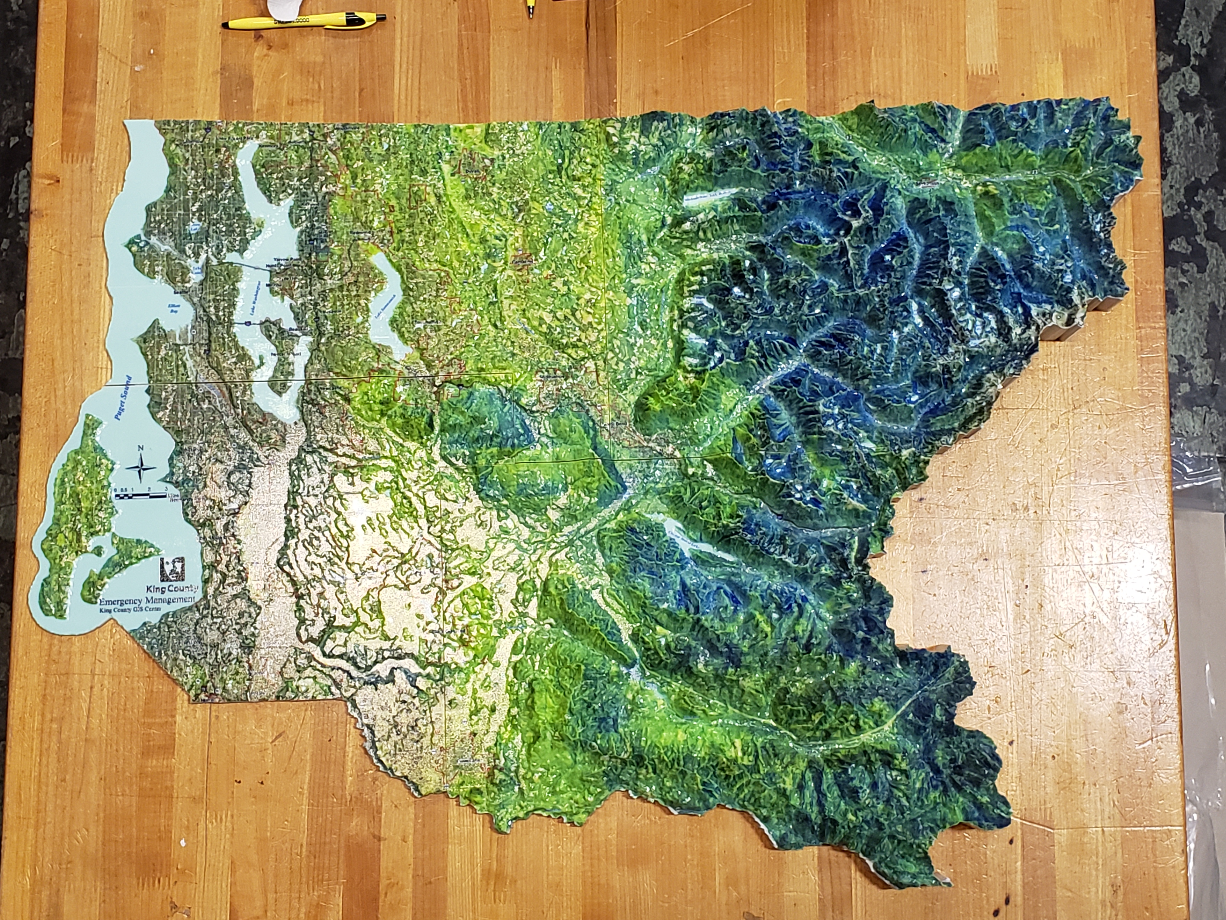
The 3D printed model 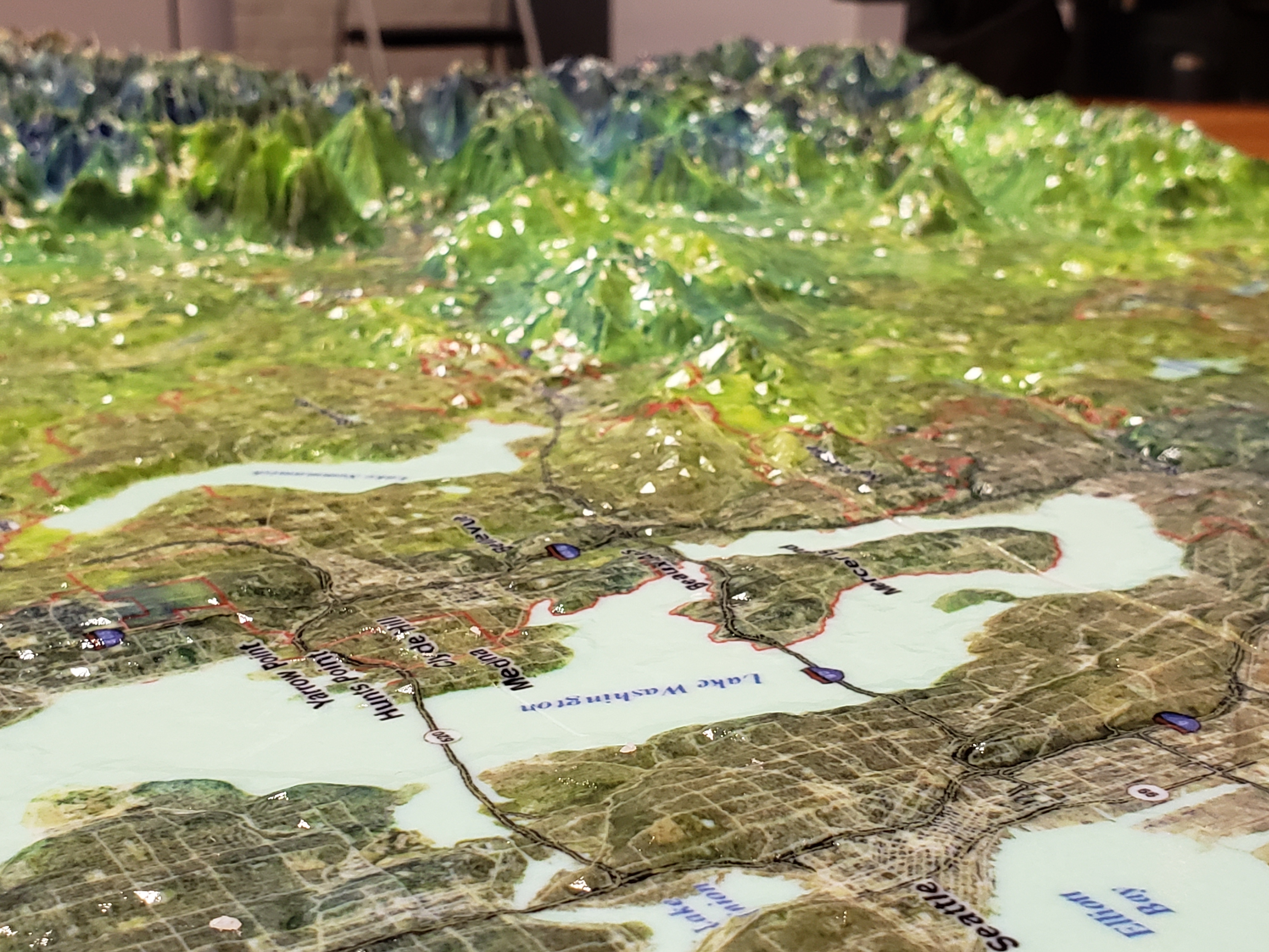
The 3D printed model–Sound to mountains 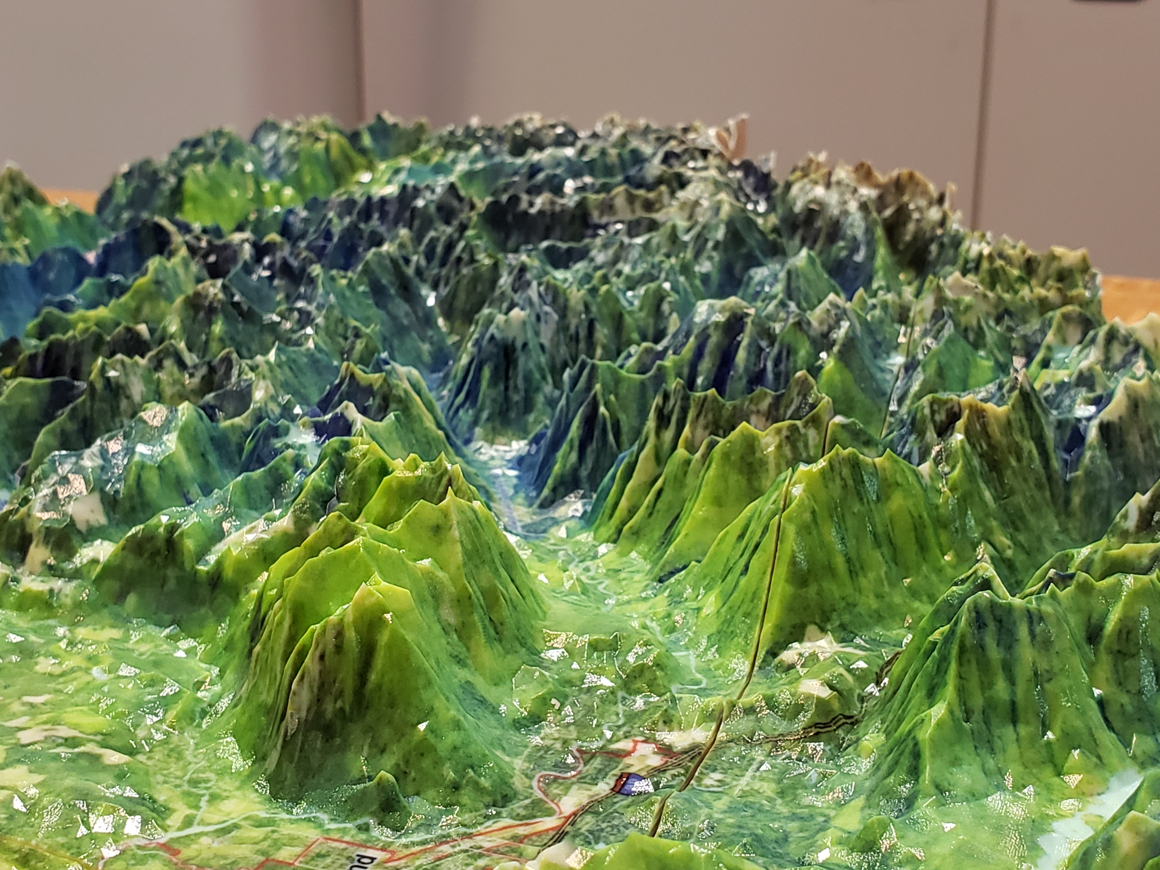
Looking up the Middle Fork Snoqualmie valley
After we went through our Blender and 3D printing process, we discovered that the ArcGIS 3D modeling software CityEngine can export to the OBJ format. I’ll save that technique for a future post.


Pingback: Converting digital terrain data into a 3D printed model of King County | GIS & You
Pingback: GIS Day 2020 – King County GIS looks back and looks to the future | GIS & You
Pingback: Maps for emergency management in King County | GIS & You