In a former life I taught the Esri Authorized course “Introduction to ArcView GIS 3.0.” One of the hardest concepts to teach my students was map projections. In a nutshell, map projections contain the errors that must be introduced into a map in order to display the curved, convex surface of the earth on a flat screen or piece of paper.
This enjoyable article with demonstration video is one of the best illustrations of the concept of map projections that I’ve ever come across: Vox.com—All maps are wrong. I cut open a globe to show why.
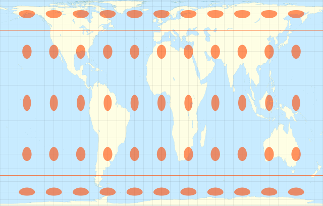
Gall-Peters equal-area projection
By Eric Gaba (Sting – fr:Sting) [GFDL], via Wikimedia Commons


