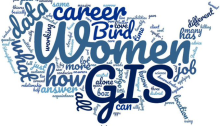
Women in GIS – March 2024

The King County GIS Center is featuring 19 women in GIS from several agencies, highlighting the broad applications of GIS. These women express their passion for GIS and how it has shaped their careers and perspectives. GIS professionals in various fields highlight the power and versatility of GIS and its potential to influence decision-making and create meaningful visualizations for communities. They underline the importance of staying updated with GIS technology and collaborating with colleagues and GIS communities. These women are paving the way for GIS enthusiasts and emphasize the broad range of opportunities in the GIS field across different industries.
Understanding Users of Tabular GIS Data

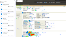
The King County GIS Center embarked on a modernization project for its public reporting application, facing challenges in identifying its user base and their needs. Leveraging Microsoft’s Clarity, the team discovered key insights about user behavior, leading to significant UX improvements. The new Districts and Developments report aims to address user needs more effectively.

GIS Software Utilization

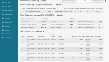
Who is using ArcGIS Pro anyway?

Understanding GIS software usage at King County, WA Given that ESRI is ending support for ArcGIS Desktop in 2026, the King County GIS Center needed to understand the migration of users from ArcGIS Desktop to ArcGIS Pro. Specifically, we wanted to know who is using ArcGIS Pro and how often they’re using it. Today we…

Virtual to physical: translating a 3D landscape to a printed model

As the most-used GIS packages, ArcGIS and QGIS are amazing and powerful for analytical applications. Despite their analytical strengths, they sometimes don’t quite achieve the quality needed for high-level graphics. It’s common for cartographers to prepare maps or layers of maps in ArcGIS, then export them for use in Adobe Photoshop or Illustrator where more sophisticated graphic techniques can be applied to create finished map products. The King County GIS Center recently came across another need to go beyond the graphic capabilities of ArcGIS.

Communities using maps to enact environmental justice

GIS & You readers know that I have written several articles in the past about using GIS for issues related to Equity and Social Justice (ESJ). A new article in Directions Magazine Insights on Location by Chris Wayne provides an excellent overview of Communities Using Maps to Enact Environmental Justice. Chris Wayne’s article touches many…

King County Solid Waste uses GIS to assess equity and social justice programs

A King County policy priority is building equity and opportunity for all. King County’s pro-equity policy agenda has eight focus areas, one of which is environment and climate. Recently I worked with the King County Solid Waste Division to help develop an ArcGIS Online web application for the equity and social justice (ESJ) assessments of…

June KCGIS User Group meeting: GIS Potpourri

Potpourri, so says Wikipedia, ‘…is a mixture of dried, naturally fragrant plant materials, used to provide a gentle natural scent, commonly in residential settings.’ What’s that got to do with GIS? Potpourri is also a common Jeopardy category – a collection of incongruous things. Maybe that’s what’s intended by the June 2019 King County GIS…