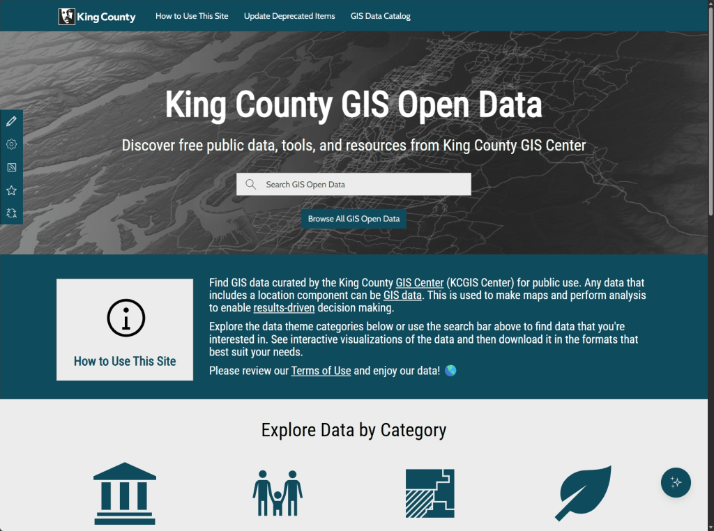
As part of the GIS Center’s on-going data modernization efforts, we launched our renewed GIS Open Data site at the beginning of 2026. It’s got a fresh new look that matches the style of kingcounty.gov and it’s been simplified to help you find and use our data as quickly as possible. Additionally, the hosted Feature Services that provide the data are now hosted in ArcGIS Online instead of our on-prem ArcGIS Server. This allows us to provide you with the performance, availability, and reliability you’ve come to expect from ESRI’s map, app, and data services.
If you have an app or map that consumes data from King County, please verify that it’s using our ArcGIS Online hosted services. The legacy Open Data Feature Services and their associated items in ArcGIS Online will be retired on June 1, 2026. They have been marked as deprecated and are considered non‑authoritative. The summaries now have a warning about the June 1st retirement, and the description has been updated to include a notice and some links to help you migrate to our current Open Data services.
If you’ve already completed this conversion, thank you. If not, please migrate as soon as possible. If you need help, or have any questions, please contact us at giscenter@kingcounty.gov.
Swapping Services
As an example, let’s look at the layer we call “address_points” internally or “Addresses in King County” on Open Data.
Here’s the new version in Open Data:
https://services.arcgis.com/Ej0PsM5Aw677QF1W/arcgis/rest/services/ADDRESS_POINT_642/FeatureServer/0
And here’s the legacy version (now only in ArcGIS Online):
You’ll notice that the ArcGIS Online hosted layers have a service URL starting with https://services.arcgis.com/ and the legacy layers have a URL starting with https://gisdata.kingcounty.gov/ If you see a URL with “gisdata” you’ll need to replace it before June 1st, or it will stop working.
In A Web Map
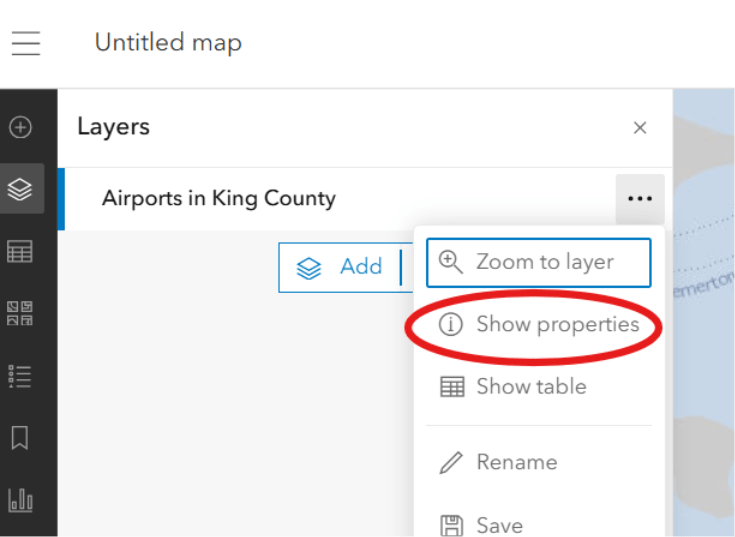
In web map, click the ellipsis and choose Show properties:
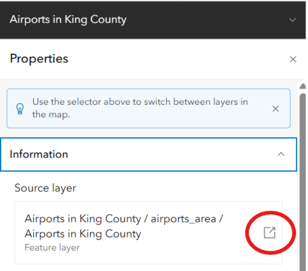
In properties window, click the down arrow next to Information and click the link next to the Source layer:
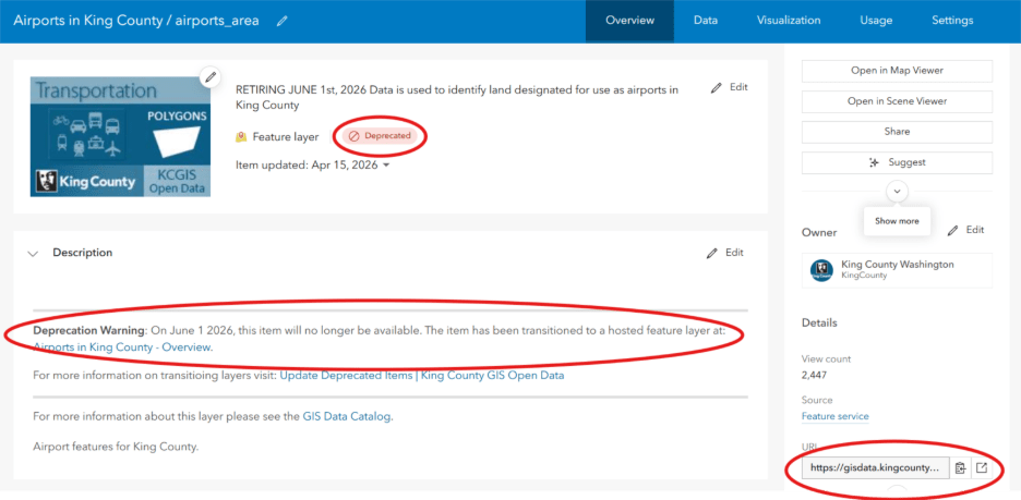
Legacy Open Data items are marked with a Deprecated badge. Additionally, the URL uses https://gisdata.kingcounty.gov/ which is the server that will be retired. Finally, the Deprecation Warning tells users that the layer will be retired on June 1st and which layer to use as a replacement.
For further information on transitioning the layers you’re using please refer to the Updating Deprecated Items page on our GIS Open Data site.
Double-checking
In summary, double check to make sure you’re not using any deprecated layers. If you find that you are, then you can look up the replacement layer by searching for the title on our refreshed GIS Open Data site or the GIS Data Catalog. All GIS Open Data layers currently marked as authoritative and visible to the public are hosted on ArcGIS Online. The legacy Open Data layers will stop working on June 1st.
Thank you for helping us to complete this transition. We can’t wait to see the cool maps and apps you’ll build using King County’s Open Data.
PS. We’ll be presenting this work on Thursday, May 21st from 11:30 to noon at the 2026 WAGISA conference.


