King County’s Septic and Group B Records Search

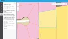
Public Health and the GIS Center launched a new map-based application in August 2023, consolidating septic and Group B water system records. The app simplifies access to records and provides valuable information for homeowners, potential buyers, companies, and real estate professionals. The application’s successful implementation has been well-received and praised for its ease of use and efficiency.
King County GIS Center receives URISA’s 2023 Exemplary Systems in GIS Award

I recently attended the Urban and Regional Information Systems Association (URISA) annual GIS-Pro Conference in Columbus, Ohio. The 2023 URISA ESIG Awards One of the highlights of the Conference is the annual awards breakfast, where inductees into the GIS Hall of Fame are announced, as well as various service awards to URISA members, committees, and…

King County launches Local Food Finder

Access to fresh, locally-produced food is a priority for many in King County, just as raising consumer awareness of these products is essential to the success and viability of farms and other agricultural businesses. On July 13, King County launched its new Local Food Finder, a convenient, mobile-friendly, GIS-enabled, interactive map which identifies where and…

Virtual to physical: translating a 3D landscape to a printed model

As the most-used GIS packages, ArcGIS and QGIS are amazing and powerful for analytical applications. Despite their analytical strengths, they sometimes don’t quite achieve the quality needed for high-level graphics. It’s common for cartographers to prepare maps or layers of maps in ArcGIS, then export them for use in Adobe Photoshop or Illustrator where more sophisticated graphic techniques can be applied to create finished map products. The King County GIS Center recently came across another need to go beyond the graphic capabilities of ArcGIS.

2019 Aerial Imagery: from camera to map

As King County was taking delivery of the 2019 digital imagery data from its vendor, EagleView Technologies, GIS analysts, cartographers, and software engineers across King County government, plus users of our GIS products throughout the area, anxiously awaited the creation, from the delivered data, of a variety of secondary imagery products for use in their analyses, maps, and applications.

Visualizing sea level rise on the Duwamish River

The King County Department of Natural Resources & Parks oversees several ecological restoration sites along the Duwamish River. Because the river is estuarine and will be impacted by the rising ocean levels associated with climate change, there was understandably some concern that these sites would also be affected. They needed to visualize what their projects…