It has been a mere 10 years since then Governor Christine Gregoire chose a tunnel option to replace the Highway 99 Alaskan Way Viaduct. Replacement of the viaduct was urgent because of the damage done to the viaduct by the Nisqually Earthquake. The new SR 99 tunnel is now open to the public! Remember Bertha?

WSDOT simulation
Our February Where in King County? question is about tunnels.
For many years I lived on Mercer Island and traveled to and from my King County GIS Center job in Seattle by Sound Transit Route 550 bus. Every day my commute was made possible by the I-90 Mount Baker Tunnel. Once the route 550 bus approached downtown Seattle, it entered the Downtown Seattle Transit Tunnel.
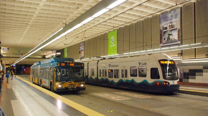
Downtown Seattle Transit Tunnel University Street Station (Steve Morgan photo used via Wikipedia CC license)
For 10 years now I have lived in Edmonds and normally I commute via Sound Transit Sounder train.
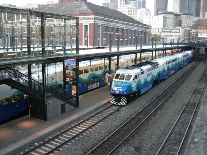
Sounder trains at Seattle’s King Street Station (Joe Mabel photo via Wikipedia CC license)
The Sounder runs on BNSF Railway tracks that traverse downtown Seattle via the old Great Northern Tunnel.
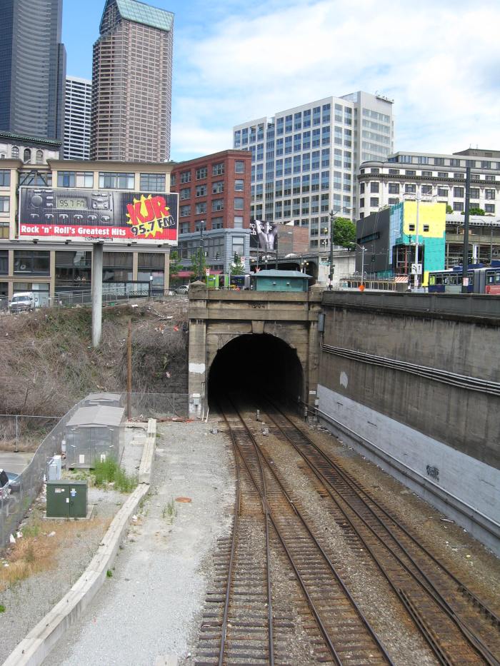
South Portal of the Great Northern Tunnel in Seattle (dwegner photo used via Wikipedia CC license)
So there are three tunnels in downtown Seattle that serve either transit or vehicles.
The curious thing about my Sounder Commuter Train commute via the Great Northern Tunnel is that each trip I cross other tunnels that carry transit or vehicles three times. How can that be? There are only two other tunnels.
The February Where in King County? question is what are the three tunnel crossings that the Great Northern Tunnel makes?
You can answer this question using iMap. Easy, just launch iMap and turn on the tunnel layer, correct? Hmmm…there is no tunnel layer. Ummm, look at aerial imagery and use the sub-surface filter, correct? Ahhhh…that’s not going to work.
To answer this question you need to select the correct options from iMap. The tools that you need to answer this question are all here waiting for you…

iMap toolbar
…here in your handy iMap toolbar.
The answer to this month’s Where in King County? question has three parts.
First, you will need to provide the following information for each of the three crossings of the Great Northern Tunnel:
- The name of the tunnel that the GN Tunnel crosses
- The nearest surface cross-streets to the crossing
Second, you must also describe which iMap basemap and layers that you used to determine the information for each of the three crossings.
Third, provide the name and location of another tunnel that you can use to cross King County’s border.
Once you have your answer, enter the information in the comments section below (include your name). The first correct answer received will earn the winner a dandy prize.


Pingback: Where in King County? Exploring Census Viewer | GIS & You
SR99 Tunnel, under 1st Ave between Pike & Union Streets
Transit Tunnel, under 3rd Ave between University & Seneca Streets
Transit Tunnel (again), near the intersection of 4th Ave S and S Washington St
I used the OpenStreetMap basemap, with all layers off.
Snoqualmie Tunnel under Snoqualmie Summit ski area might be the only tunnel people can use to cross King County’s border.
LikeLike
Mike MacDonald… Congratulations on answering this question correctly, even though more than 3-1/2 months after I first posted it! Curious that Snoqualmie Tunnel, part of the Palouse to Cascade trail, is the longest of the four trails. Please verify your email address and I will send you your dandy prize.
LikeLike