It is a truism to observe that a vast majority of international borders are delineated by geographical features. Oceans, mountain chains, rivers, on and on. So it is with much of the border between Mexico and the USA.
The Western Half

Except as otherwise noted, all images are from “The Wall” by USA Today.
From Tijuana, Mexico, to El Paso, Texas, the border runs in mostly straight lines, cutting across numerous mountain chains and deserts.
It is rough and inhospitable terrain, yet much of this section of the border already sports some form of border wall—constructed at great cost to taxpayers and private land owners. The Secure Fence Act of 2006 allowed the US government to seize private property in order to build many miles of barriers. Out of 300 land condemnations that followed the passage of this act more than 80 are still in dispute. (USA Today)
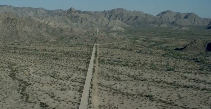
Existing barriers juxtapose anti-personnel fences with anti-vehicular fences. Barrier styles are driven to a large extent by the terrain. In the next image the ground is covered by deep, soft sand which makes walking extremely difficult, ergo the transition to anti-vehicular fencing.

The Eastern Half

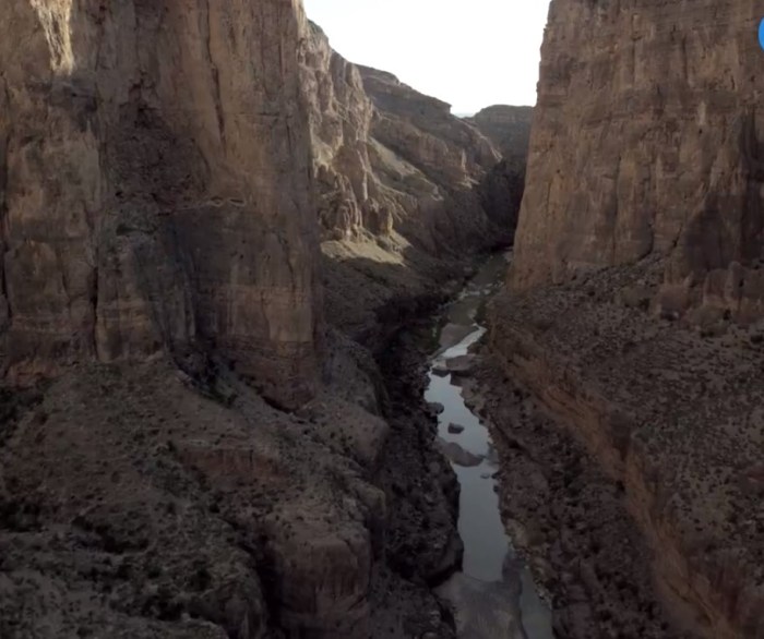
Continuing east of El Paso to the Gulf Coast near Brownsville, Texas, the border is demarcated by a river—the famous Rio Grande. In geological terms, the Rio Grande is an “old” river. Near Big Bend National Park the river’s course scrapes the bottom of a deeply carved mini-Grand Canyon.
After hundreds of miles of formidable countryside the terrain levels out toward the Gulf of Mexico. The flow of the Rio Grande slows to a snail’s pace, depositing all that carved-out material, infilling the ancient river valley such that the river’s course must negotiate innumerable S-turns. Constant erosion gradually rearranges these turns. Today the border may be underwater at a given point, then a decade or so later it may be on dry land at that same location.
With a steady supply of water much of the lower Rio Grande valley hosts an unbroken stretch of farmlands, which belong to some 5,000 owners. Many are fourth- and fifth-generation or even sixth-generation owners and all depend on direct access to water for their livelihoods.

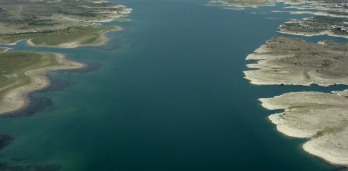
Two sections of the Rio Grande have become sizable lakes behind dams, such as the one forming Lake Amistad.
The Big Question
What would it mean then to build a “big, beautiful wall” along such a border?
 USA Today, a multi-platform news and information media company, sought to answer that question by literally helicoptering along every inch of this amazing border, from the Gulf of Mexico to the Pacific Ocean, posting about 20 hours of aerial footage online. More than 30 reporters and journalists interviewed migrants, farmers, ranchers, tribal members, and even a human smuggler.
The USA Today team also worked extensively with a Geographic Information Systems (GIS) project manager at Arizona State University to process and analyze Department of Homeland Security satellite imagery and federal maps to ensure accuracy and completeness.
The illuminating results of these efforts have been posted in “The Wall.”
To begin examining the border, jump right into the map section of The Wall. Scroll down and read the intro—it’s worth it. Then select “Explore the map” and when it symbolizes the border note the extent of existing walls/fencing.
Choose “See all layers” and then “Read more about this data.” Scroll to the top and don’t miss the VR (virtual reality) trailer. Scroll down to read the excellent commentaries. Check out the many audio/photo/video essays near the bottom.
Back out or reload the map section and choose “Skip intro,” then the blue button “View aerial footage,” and finally select any part of the border to open a video of the helicopter flyover that includes that border section. Each individual video covers a roughly 20-mile border extent. Click or tap the Run arrow to view a segment and when it ends simply click or tap the Run arrow again to see the next segment, or select “Back to the map” and drop the helicopter icon on any other part of the border.
Designing real-world solutions to real-world problems demands real-world information. Geography, once again, still and forever, rules.
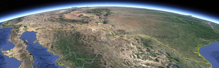
Source: Google Earth
Gunnar Goerlitz is a GIS analyst in the KCGIS Center Spatial Services group.


