
Last year we featured Women in GIS for King County’s Women in Technology event. The women featured were exclusively those within the King County GIS Center. This year those same women and I nominated several women throughout King County (outside of Information Technology) to feature. It is my honor to introduce 20 women in GIS from 9 agencies in King County.
I am also adding two women from King County IT, Valerie Bright, who has recently joined the KCGIS Center, and Alicia Brown, who is in the Data Service.
The women featured have been included by the King County agency they work for.
Department of Assessments
Christie Most

What have you learned from your journey as you have advanced your career using GIS?
How would you encourage people to add GIS to their skillset and how has doing so for you changed your perspective or career trajectory?
While GIS is about location and there is much ado about boundaries and edges there are no limits to where you can apply GIS in your career.
GIS has such a broad application and is not relegated to one type of learner or profession. Take a class, play with the software, find a mentor, don’t be afraid to break things.
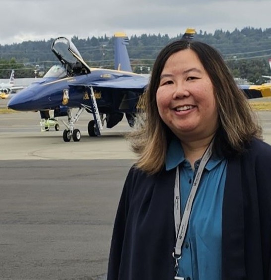
King County International Airport
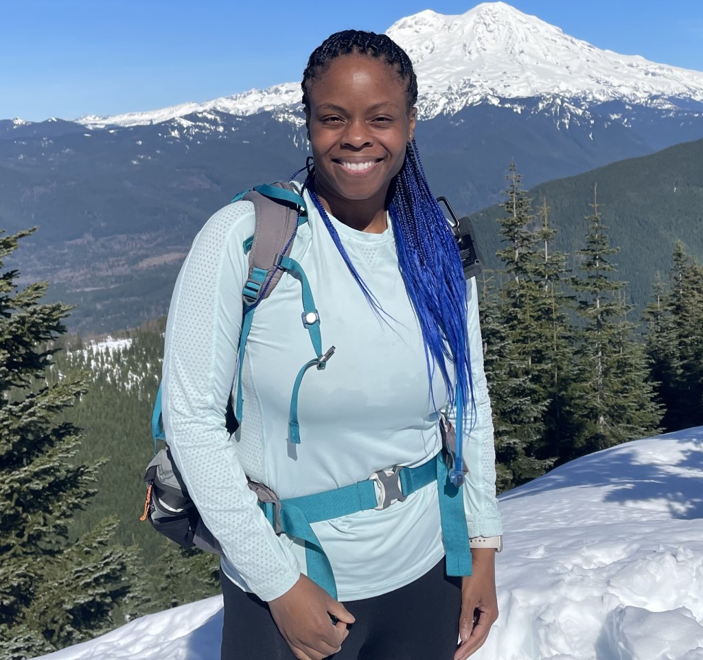
Vanessa Chin
What have you learned from your journey as you have advanced your career using GIS?
How would you encourage people to add GIS to their skillset and how has doing so for you changed your perspective or career trajectory?
Professionally, GIS was my first love. I love people, their individual stories, lived experiences, and our connection to earth, travel, spaces, and places. My career began with GIS as an intern with King County International Airport (KCIA/BFI), when ArcView 3.x was transitioning to ArcGIS Desktop 8.0. I am very grateful for my journey to be rooted in three spaces I love most: people, aviation, and technology. GIS is a powerful platform for connecting humans, location, and critical environments like airports. Over the years, I have lead various projects centered with GIS on our path contributing to a digital twin and other tools for values-driven, data-supported decision-making at our airport (e.g. FAA Airports GIS features, airport operations viewer, wildlife management, data visualization and dashboards, property management, construction projects, airspace obstructions, pavement management, etc.). It is inspiring and exciting to be a part of a community in GIS who leverages the powerful solution for airports to operate equitably, efficiently, and effectively.
GIS enhances the lens in the way you see and experience to the world. I would encourage adding the “Science of Where” for storytelling, answering questions that impact our communities, and for deeper dives into understanding our environment and the future. I am curious of where the future of GIS will take us with Artificial Intelligence and Machine Learning. My journey with GIS has lead me to a thriving, fulfilling, and rewarding career at KCIA/BFI as the Innovation Section Manager. It is so fun to have grown along with the Airport, which has spawned so many career growth opportunities where I am able to apply my strengths. Along with serving as KCIA’s Innovation Section Manager, I co-lead KCIA’s Equity Racial Social Justice initiative, chair the Diversity Equity and Inclusion (DE&I) for both the Northwest American Association of Airport Executives (NWAAAE) and Washington Airport Management Association (WAMA), and beginning in April serve as a member of the Transportation Research Board (TRB) of the National Academies of Sciences, Engineering, and Medicine (NASEM)’s Aviation Aircraft/Airport Compatibility Committee. With GIS, the possibilities are endless!
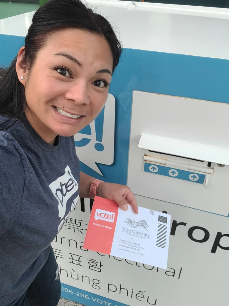
Elections
Katrina Sroufe
What have you learned from your journey as you have advanced your career using GIS?
How would you encourage people to add GIS to their skillset and how has doing so for you changed your perspective or career trajectory?
I have learned to be open to change and keep learning and expanding your skillset with emerging GIS technology. Work collaboratively to understand and engage your team, colleagues, and stakeholders by always keeping communication open. Share your knowledge and ideas and know that you are part of a larger community of GIS professionals and women here to support each other.
I would encourage people to add GIS to their skillset by asking questions, what is GIS and how can you apply it to your field and expertise? GIS professionals wear multiple hats. You are the creator of spatial data, the go to subject matter expert, the map maker, the analyst, the data disseminator, the project leader, and you bring people together with spatial data in many different formats and GIS products. The GIS skillset can be applied to a wide variety of government functions and private sector jobs. My perspective and career have specialized in GIS Elections for the past 18 years, applying the GIS tools to mapping districts, precincts, and voter address spatial data. Elections GIS drew me in early in my career because of the culture of teamwork, transparency and equity and I have been hooked ever since.
Kristina Rose

What have you learned from your journey as you have advanced your career using GIS?
How would you encourage people to add GIS to their skillset and how has doing so for you changed your perspective or career trajectory?
I’ve learned how important it is to have good mentors and if a mentor does not find you, then you need to find them – especially early in your career. When I worked for the National Park Service I was surrounded by amazing women who taught me not just how to be a good colleague, but I saw how I wanted to BE as a woman further in my career. Specific to GIS, I have learned that we always have to look forward to where the field is going and where software is going. I feel like an old lady sometimes, shaking my fist at the literal cloud that I am supposed to start storing more of my data in. It feels uncomfortable to change how I do something, but change is necessary.
My career trajectory has always been GIS. The minute I found out what GIS was in college, that was it. I knew I wanted to make maps and I knew I wanted to work in the public sector. I would encourage people to explore how GIS may relate to their field. I think a great entry point to GIS is Story Maps. Identify some information that you want to get across and put it in a Story Map. They are fun, easy, and everyone loves them. So many questions can be answered with a map!
Department of Natural Resources & Parks
Water and Land Resources Division
Megan Kim

What have you learned from your journey as you have advanced your career using GIS?
How would you encourage people to add GIS to their skillset and how has doing so for you changed your perspective or career trajectory?
I have been using GIS for the entirety of my career, and largely self-taught. I started using GIS while farm planning for the Oahu Soil and Water Conservation District, as a fresh-faced University of Hawaii at Manoa college graduate. I moved from Oahu to Snohomish Conservation District, where I continued making maps for farmers. It wasn’t until I started with King County that my skills really excelled. Over the last decade, I have been increasingly interested in data management for the Public Benefit Rating System program (PBRS), a program in which I help administer. With a team of only two, me, and my colleague Bill, we are responsible for tracking 15,000 enrolled acres (1,700 owners) and we do so with an MS Access database and GIS. This exposure to daily interactions with both the PBRS database and GIS piqued my curiosity about the best uses for the data we are collecting and where we could make improvements. This mindset, with the help of GIS and pivot tables (!) played a large part in my recent reclassification from a Program Project Manager (PPM) II to a PPM III.
GIS can be intimidating when starting out. However, adding GIS to your skillset is broadening your ability to analyze spatial data, visualize patterns, and gain insights that can assist in decision-making. For me, GIS has been a powerful tool for PBRS, which may be a program small in staff, but mighty in administration and monitoring. One of the most valuable skills I have learned is how to leverage data from multiple sources to help with PBRS monitoring along 303(d) listed streams, as well as targeted marketing efforts for Land Conservation Initiative-identified properties in those geographic areas.
Andrea Wong

What have you learned from your journey as you have advanced your career using GIS?
How would you encourage people to add GIS to their skillset and how has doing so for you changed your perspective or career trajectory?
One of the biggest things I’ve learned is that career paths often change from what we set out to learn in college. Pursue development and training in things that are interesting to you, even if it isn’t directly in line with what you studied in school. I didn’t have time or space to learn GIS in college with my rigorous engineering curriculum, but I knew it would be a useful skill to know in the environmental field. So I learned a little bit at an internship and expressed interest in developing this skillset further at my first consulting job. Through advocating for myself and with support from my first workplace, I improved my GIS skills and eventually shifted from environmental consulting to GIS inventory and data management. I really enjoy the work I do now, and it’s something I wouldn’t have figured out if I had limited myself to just engineering as I’d studied in college.
If GIS is something you’re interested in, start looking into trainings online to give you a basic understanding of the technology and how to use it. If work supports this, great! If not, take just a few hours a week to get familiar with the technology and how to use it. Once you have the basics down see if there are small tasks or projects, work or otherwise, that you could tackle using GIS or an online GIS-based web map or application. If it’s an option, UW also offers a GIS Certificate Course that has a bit more of a structured curriculum. As mentioned above, learning GIS and developing these skills has changed my career trajectory from engineering to data management. I still get to work in the environmental sector, I love what I’m doing, and I feel like it’s given me a foundational data management background that would be useful if I ever need to change jobs or sectors.
Lusha Zhou

What have you learned from your journey as you have advanced your career using GIS?
How would you encourage people to add GIS to their skillset and how has doing so for you changed your perspective or career trajectory?
I trained as a geographer, and one of the most basic tenets of geography is unevenness. The playing field is not level, as terrains are not, and people have varying information, as we collect different sets of life experiences. Yet computerized spatial analysis currently requires, if not perfect information, at least consistent data schema design. So my career in GIS is also one in information management and data quality. Recognizing the unevenness of one’s data – and the limitations of an analysis – helps identify opportunities to improve. I find it crucial to engage with data editors, GIS map and application users as they have the grounded experience to call out the mismatches between a geodatabase model and complex real examples. Maps and data visualizations are powerful and influence decision-makers. Improving the data and thus analysis requires a collaborative and collective effort. Improving geographical literacy becomes a foundation for well-informed decisions and positive outcomes.
GIS is everywhere! Do it in a way that is useful or meaningful to your life or work. For example, I use Google My Maps to trip plan and share recommendations, and Story Maps to capture travel. In my old town, I also analyzed vegetation cover, part of advocacy for increased building setbacks and tree canopy protection.
Esri dominates the spatial analysis market, but they have student pricing and non-profit discounts. There are also plenty of mature open-source tools like QGIS, PostGIS, or GRASS. I would suggest an (often free) online course through Coursera or EdX for the foundations.
Anne-Gigi Chan

What have you learned from your journey as you have advanced your career using GIS?
How would you encourage people to add GIS to their skillset and how has doing so for you changed your perspective or career trajectory?
There are many ways to do the same thing in GIS, and figuring out which way works best for you is part of the fun. I also learned that it is important to document my workflow. I find that folks I have encountered who are interested in GIS are usually very interested in sharing their knowledge, and I love having that hive mind available when I get stumped!
So much of our work is data-driven and GIS allows us to understand, utilize, and present the data. If a picture is worth a thousand words, a well-constructed map is worth even more! When I started my career in land conservation, I looked at GIS as “just” a useful tool. And as I use it more and more in my day-to-day work, I find myself really enjoying the time I spend using GIS to run analyses and make maps for various audiences. I am happy to be the go-to GIS person in my work group and look forward to getting the ad hoc GIS tasks and helping my coworkers solve some of their GIS problems.
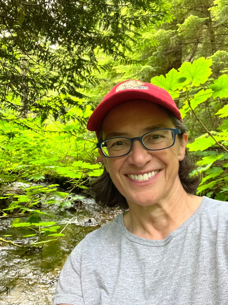
Jennifer Vanderhoof
What have you learned from your journey as you have advanced your career using GIS?
How would you encourage people to add GIS to their skillset and how has doing so for you changed your perspective or career trajectory?
I learned very early how helpful and necessary GIS is for me to do my work. I have been an ecologist in the Science Section’s Watershed and Ecological Assessment Unit for nearly 25 years, and I have used GIS for nearly every project and program I have worked on during that time. As an ecologist, I can’t imagine working without it. From mapping habitat patches while conducting ecological assessments of King County’s natural areas, to tracking annual observations of spawning salmon reported by Salmon Watcher volunteers, to digitizing land cover and analyzing land use change along rivers and streams, to studying wetland and riparian areas to identifying changes in beaver systems, estimating backwater flooding and water storage from beaver dams, and designing vegetation research at salmon restoration sites, my job would not be possible without GIS.
The amount of geospatial information we have at our fingertips is incredible – if you can imagine a spatial dataset, it may already exist, or maybe you’ll be the one to help develop it. Anytime a student asks me for tips on what to learn to be more likely to get a job after graduation, I tell them to learn GIS. If you aren’t using GIS yet but suspect it would be helpful for your work, take some training classes then immediately put your training to work with a project or project idea. It doesn’t take long to realize how powerful this tool is.
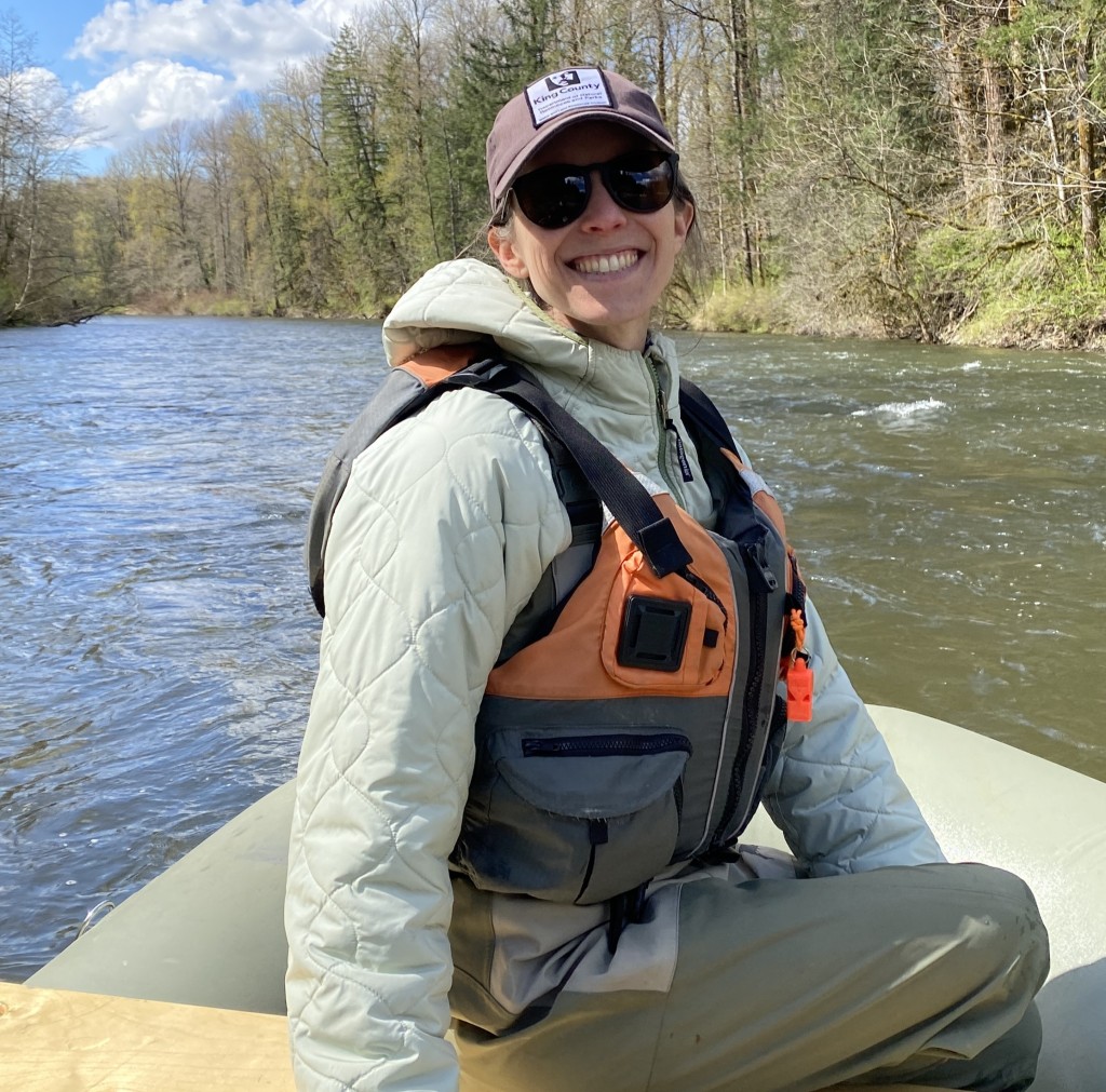
Alex Lincoln
What have you learned from your journey as you have advanced your career using GIS?
How would you encourage people to add GIS to their skillset and how has doing so for you changed your perspective or career trajectory?
As an ecologist in the new WLRD Capital Section, I’ve learned how important GIS can be not only in planning projects but also in evaluating capital project performance and habitat change. GIS is allowing us to use remote sensing data more effectively and develop new cost-effective methods for tracking project performance.
Learning to use GIS can be intimidating at first, but you can still do a lot with just some of the basics. Your colleagues are often a great resource when you have questions!
Judi Radloff
What have you learned from your journey as you have advanced your career using GIS?
How would you encourage people to add GIS to their skillset and how has doing so for you changed your perspective or career trajectory?
As a geologist, I learned early on the immense power and importance of GIS, and for a modern geologist GIS is indispensable. I love maps and mapping including the art of cartography and this love drew me toward the earth sciences. I am a bit too old to have learned GIS in school so I have had to rely on OJT and tons of support from sympathetic colleagues and direct reports who “do the work” for me as I follow along, hack my way through the complex spatial analyst menus and tools, and try not to mess up the maps and files. Some of my earliest GIS instruction was over Skype by a skilled (woman) practitioner I often worked with who was based in Bellingham.
If you want to use GIS (and pretty much every geologist does!), start early and use it often. Continue to hone your skills as new tools become available, learn best practices for file management, and confer with colleagues for tips and tricks. Don’t be afraid to ask, “How did you do that?!” when you see something cool and I’m guessing you should also learn Python, though I have not. If you are not supported in your workplace to use licensed Esri products, the free online versions are a good place to start, including Google Earth (another game changer), Saga, and QGIS (which I have never used but I hear are easy).
Kate Akyuz
What have you learned from your journey as you have advanced your career using GIS?
How would you encourage people to add GIS to their skillset and how has doing so for you changed your perspective or career trajectory?
I’ve learned that many folks understand information visually much better than they do by reading statistics in a text or table. With GIS folks can visualize data about very different kinds of information on the landscape, interpreted to visual scales that allow comparison. In that way, you don’t need to be an expert in every subject matter to understand what is happening in your community.
I’m a technology early adopter. I can say with certainty that no new computer technology – not even AI – has changed the way I work and the efficiency of my work more than GIS. The ability to view a wide variety of raw and interpreted data, in the same geography, instantaneously, was a radical transformation to the way I work. In my opinion, GIS is an essential skillset for any planner, engineer, environmental scientist, or communications specialist that is presenting to inform the public or decision-makers.
Wastewater Treatment Division
Shari Cross
What have you learned from your journey as you have advanced your career using GIS?
How would you encourage people to add GIS to their skillset and how has doing so for you changed your perspective or career trajectory?
Cartography, analysis, programming, and web application development…..GIS is filled with endless opportunities to focus on whatever area you are interested in. You’ll never be bored becoming a GIS professional!
GIS can be your primary focus or a part of your overall skill set. Being able to present information in a spatial/geographic format helps people connect with your message on a deeper level. Mastering the art of maps, dashboards, charts, graphics, and more can transform your subject matter into something relatable on a new level that just reading can’t provide.
Monica Van der Vieren
What have you learned from your journey as you have advanced your career using GIS?
How would you encourage people to add GIS to their skillset and how has doing so for you changed your perspective or career trajectory?
In my position, I serve as a liaison between our agency, project teams, and the public. I believe GIS tools are indispensable for communicators. Everything we convey is about a place that means something to people who live, work, study, and play there. Our capital projects build, repair, and replace large infrastructure that people may not be aware of.
I have learned how important GIS is in place-based storytelling to engage our communities. GIS may sound purely technical, but it helps us show how our facilities are woven into the life and health of our communities. Now, we can even tell that story in 3D, so people can “see” what is underground in their communities.
On the other side, we can use GIS to evaluate whether our outreach is comprehensive and equitable across our service area. GIS tools let us overlay our engagement data with community data, revealing impacts and opportunities that can improve our service to communities and teams.
My first career was in research science. We worked in an anatomical system, not a geographic one: organs, tissues, cells, and all the way to the genetic level. But the location of biological elements and activities—even genes– is just as important as the location of infrastructure and people! Coming to WTD, I transitioned from working in one locational information system to another.
I am working with our WTD GIS team to close the information loop between the public and our agency. We use GIS products to engage, inform, and educate the public. Now, our team is feeding community engagement data back into GIS systems to visualize our outreach, inform our work, and look for improvement opportunities.
Parks
Emily McGinty

What have you learned from your journey as you have advanced your career using GIS?
How would you encourage people to add GIS to their skillset and how has doing so for you changed your perspective or career trajectory?
As I have advanced my career in GIS, I have learned what a powerful agent of change and communication tool it is to have GIS in my skillset. In Parks, we use GIS to ensure that our decisions are addressing inequities and serving underrepresented communities.
I would encourage anyone who is interested to take an introductory GIS course. GIS is a skill that is in high demand and having this skill has allowed me to support many different efforts across Parks and DNRP.
Lilia Wong

What have you learned from your journey as you have advanced your career using GIS?
How would you encourage people to add GIS to their skillset and how has doing so for you changed your perspective or career trajectory?
Four years ago, I transferred to DNRP where I was introduced to GIS technology. Before that, I was mostly using a 1970’s mainframe-based application, SQL Server, and Excel to understand patterns in data (aka text-based tools). Imagine my surprise and complete delight to be able to look at data from a visual perspective. GIS is a powerful tool that allows me to continue to be creative, imaginative, and artistic when illustrating a visual story supported by text-based data.
By nature, I love organizing. For example, I have a need to organize my pantry, my garden beds, and even my tent when I’m backpacking. I always want to know where everything is at any given moment. And so it is for work, with GIS, complimented with SQL Server and Excel, I can organize my data to better understand my data; so that I can reach my goal of achieving “perfectly clean” data.
Metro Transit
Nash Chang

What have you learned from your journey as you have advanced your career using GIS?
How would you encourage people to add GIS to their skillset and how has doing so for you changed your perspective or career trajectory?
I have learned that there are endless ways to utilize GIS within the data analytics realm and that continuous learning can be both enjoyable and beneficial. Another great lesson I want to pass on is how GIS provides ways to analyze datasets with humane factors. Being able to visualize and quantify social and environmental patterns adds a human touch to statistical operations data that often lack context and are hard to decipher for audiences.
I would encourage those who want to get into GIS to start with a topic personally interested in. It’s surprising how many industries and topics use GIS so starting with a known topic is super helpful. And GIS to me is a continuous journey where I learn and apply skills/knowledge to work projects only to learn more and apply them in the future. It’s also a great combination with programming or data analytics as GIS often provides a unique perspective on the dataset, and visualized data often capture a wider range of audience. My career as a data analyst has grown in skill and diversified in industries where I can venture into next.
Colette Flanagan

What have you learned from your journey as you have advanced your career using GIS?
How would you encourage people to add GIS to their skillset and how has doing so for you changed your perspective or career trajectory?
GIS applications and uses change and improve at a rapid pace. It is important to keep up. What I’ve seen time and again over the years Is how GIS can help tell the story, in real-time, about what is happening around us. Through changing economies, pandemics, and technological advances, GIS helps analyze the world and allows us to measure both real and potential changes.
Also, it’s important to focus on the visualization of data – who is the audience; what is the data telling you; how can you most clearly tell the story in a way that everyone can understand. Don’t minimize the importance of concise and understandable visualization.
If possible, pick an area that you are most interested in and use it as the basis for mapping and analysis experimentation. Start small and look at numerous possibilities with an open mind. It’s easy to resist changing the way you work but that will only hold you back. Stay focused, stay nimble, and definitely learn to code!
For me, a more recent emphasis on Equity within transit has been a meaningful application of GIS tools. It has given me a deeper respect and understanding of how we can use GIS to improve and enrich decision-making.
Public Health
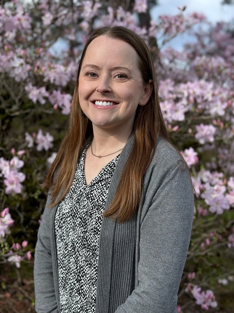
Kanita Sellers
What have you learned from your journey as you have advanced your career using GIS?
How would you encourage people to add GIS to their skillset and how has doing so for you changed your perspective or career trajectory?
Over the years, GIS has grown expediently along with technology and data analysis. It has been adopted by all types of organizations. The use of GPS, Artificial Intelligence, drones, satellites, smartphone, and Internet-of-Things sensors all serve to expand the user base for geospatial systems while also collecting more data.
One of the best ways to encourage people to add GIS to their skillset is to show them how GIS can be applied to real world scenarios and problems. It has changed my perspective to educate and guide people towards a GIS career path.
Public Safety
Miranda Brewer
What have you learned from your journey as you have advanced your career using GIS?
How would you encourage people to add GIS to their skillset and how has doing so for you changed your perspective or career trajectory?
I’ve learned that you have to keep up with trends in GIS because it’s constantly evolving. A big part of this is talking with and learning from others in the field because people are always using GIS in innovative ways that could help you solve a problem you’ve been having.
Anyone interested in adding GIS to their skillset should check out the free training on Esri’s website and consider attending GIS training courses or workshops at conferences. All of these are good resources. I took an Intro to GIS course in college and it led to a 17-year (and counting) career in GIS. My background in GIS allows me to support public safety and enhance location
accuracy in 911 applications.
King County Information Technology
KCGIS Center – Valerie Bright

What have you learned from your journey as you have advanced your career using GIS?
How would you encourage people to add GIS to their skillset and how has doing so for you changed your perspective or career trajectory?
One of the best things about working in GIS is that it’s a vast skill set that can touch just about any industry. It’s important to accept early on that you will never master all there is to know, but that each project you work on will add tools to your GIS toolbox and give you new ways of solving problems. I recently transitioned from working with the USGS to working with the GIS Center, and while I’m no longer working on groundwater hydrology, the scientific and analytical GIS skills that I picked up at the USGS are already proving very valuable in my work at King County.
Ever found yourself thinking “It would be helpful to know where …”? If so, GIS can help! If you’re just trying to add a bit of GIS to your current work, then I’d recommend reaching out to one of the women highlighted on this blog to ask a few questions or dip your toes in with one of the GIS Center’s coaching meetings.
For myself, I discovered GIS during my geology degree. I kept seeing “GIS skills helpful” in job postings, and while I had no idea what that meant I knew my program had an ‘Intro to GIS for Geology’ course. A geology+GIS position and a master’s degree in GIS later, and now I’m here at KC in a 100% GIS role and couldn’t be happier. Discovering GIS completely changed my career trajectory – I find the blend of creativity, problem-solving, and data visualization in GIS irresistible.
Data Service – Alicia Brown
What have you learned from your journey as you have advanced your career using GIS?
How would you encourage people to add GIS to their skillset and how has doing so for you changed your perspective or career trajectory?
As a very tabular data person most of my professional career in the financial service sector, I never made a map until I joined Socrata/Tyler Tech in 2015 where many of my projects with government customers involved setting up web applications with maps as the center. For the first time, I got to see a complete picture of the data and was able to easily view the distribution and availability of government services. Maps make data personal and possible to drill into your own neighborhood to see what’s going on and confirm issues you think are happening so that you can then show the proof to people in power.
Because the Socrata platform wasn’t fully focused on spatial data, I had to quickly learn how to geocode customer data using Python and FME and quickly realized that I had opened the door to a very complex world. Streets may have multiple names, crime incidents may have obfuscated street numbers like 12XX, one jurisdiction’s center point may fall in a completely different jurisdiction or a body of water, shoreline boundaries may actually be in the water, townships become counties, villages become townships, tracts may change every census, cities may be part of multiple counties, and so on. Maps are wonderful, but accurate ones are not easily made.
Make a map of your data in the tool of your choice. Power BI, Tableau, Excel, and our open data portals can all create maps from addresses or even just parts of an address like city and zip code. Look at where your team’s services are distributed across the county. Explore the maps of other cities and counties that publish the same type of data your team is responsible for. Anything they can do, King County can do too. The highly skilled GIS team in IT and other departments and agencies are always available and willing to guide you and your team on how to expand your analysis of data through maps and reporting apps. The GIS Center provides a bunch of regular meetups and coaching sessions where it’s safe to ask any question and get help visualizing your data spatially. Maps will change your world.


