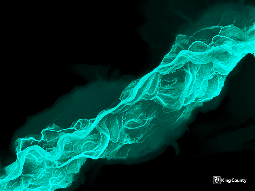
A year or two back, the Washington Department of Natural Resources made some fascinating maps of braided river channels. These maps used lidar-derived imagery to show the twisting patterns of the riverbeds in a novel way — as bright, colorful images on a black background. They looked similar to x-rays, revealing the bones of the river. Not only were they gorgeous images, but they vividly demonstrated dynamic riverine processes over time. The fine grain of the lidar data shows subtle differences in elevation, revealing old courses that the river had shifted away from centuries ago.
These maps deservedly got a lot of attention. They were noticed by the King County Water and Land Resources Division, who wanted to use this sort of imagery for a new project. Along the Green River at Flaming Geyser State Park, they were assessing opportunities for habitat enhancement. These enhancements often aim to restore the structure of the river and adjacent riparian areas to an earlier state, as much as possible to what existed before the arrival of non-indigenous settlers.


As part of this assessment, they needed to look at the history of the river and see the structure that existed 150 years ago. They knew that this lidar-based method of analysis and cartography would allow them to see that history, so they asked the King County GIS Center to help them out.
Lidar (from “light detection and ranging”), is a technology that uses lasers to survey and measure land and other objects (the concept is similar to radar, but using laser light pulses instead of radio waves). It allows the creation of elevation models that omit any vegetation or other objects that might obscure the surface of the terrain. It is highly accurate and detailed, and this accuracy makes it ideal for examining river bed morphology.
White River 
Skykomish River
Lidar visualization examples of the White and Skykomish rivers
King County has a number of high-resolution lidar data sets that cover the extent of the county. At 1-meter resolution, it works well for visualizing the subtle changes in terrain required by the client. We used a small section of that data to create the map that the Water and Land Resources Division requested. What do you think of the results?
Interested in working with lidar data? King County maintains a variety of elevation information, including lidar, at the GIS Center Data Hub.


Pingback: GIS Day 2020 – King County GIS looks back and looks to the future | GIS & You