Join us for the October KCGIS User Group meeting next Wednesday, October 2, from 11am-12noon. Our speakers will be Katrina Sroufe & Vance Julien, from King County Elections.
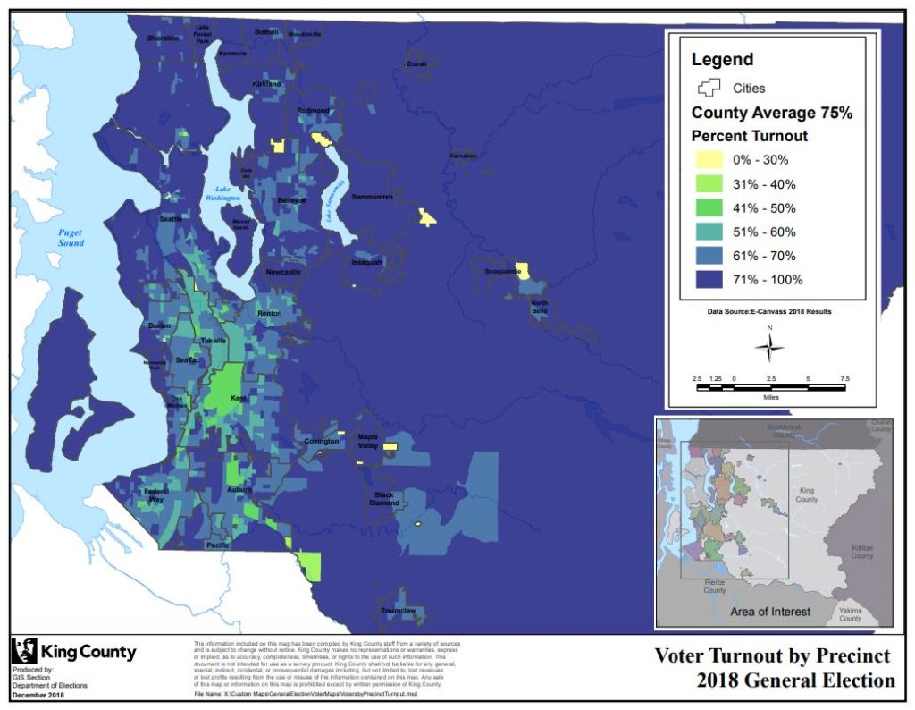
Katrina and Vance will explain how King County Department of Elections maps voter turnout to inspire the community to get involved in voting.
Other Agenda Items
New data updates
New maps
Training
Announcements
What, when, where and who:
KCGIS User Group Meeting – the first Wednesday of every other month, 11am to 12noon (with time afterwards for questions and networking
Location: King Street Center, 201 South Jackson Street, 7th floor, conference room 7044-45
The KCGIS User Group is a bi-monthly forum that features information sharing among users of the King County Geographic Information System in the form of announcements, technical tips, and in-depth presentations. Users can find out first-hand what is happening across departments and disciplines, and glean timely information that will affect their day-to-day work.
We hope to see you on October 2!


Wow! I wish I was in your county
LikeLike
Pingback: NSGIC publishes best practices guidance to improve elections with GIS | GIS & You