The responsibilities of county government are many, including elections, criminal justice, property value assessment and taxation, and dozens of others. One obscure but economically important responsibility of King County is to reduce and, if possible, prevent the negative impacts of noxious weeds. A noxious weed is a plant that can injure agriculture, horticulture, or ecosystems. Some are native, but most have been introduced into a given ecosystem by accident or ignorance. The classic noxious weed is Russian thistle—the tumbleweed of the arid American west.
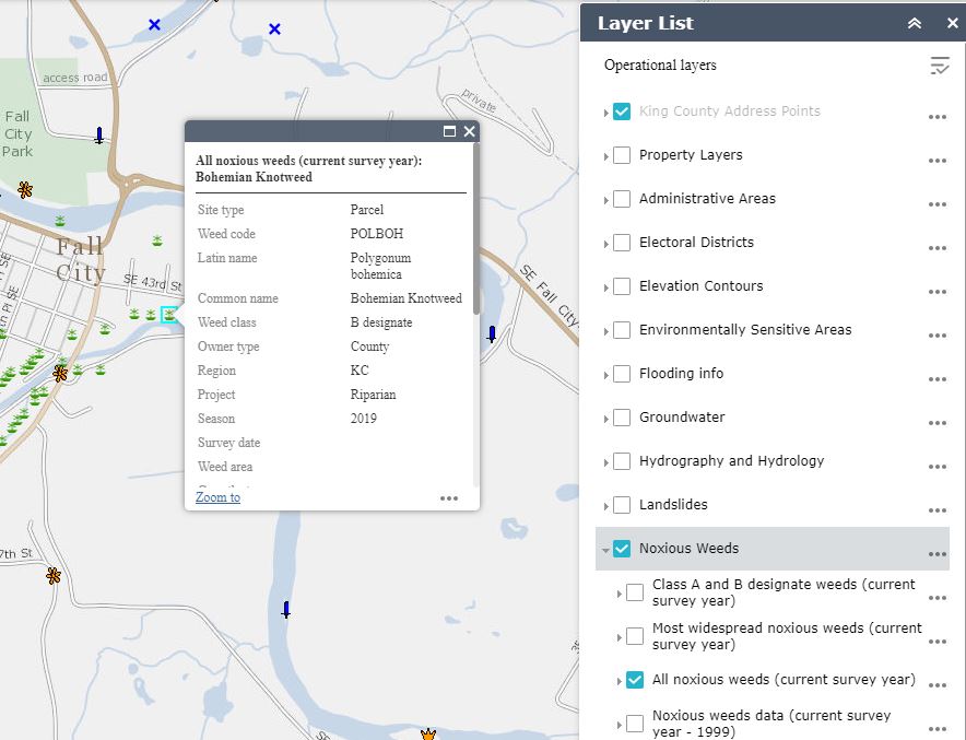
The Federal Noxious Weed Act of 1974 gave the United States Secretary of Agriculture the responsibility to identify noxious weeds and implement programs for their control. The following year Washington state passed legislation authorizing the establishment of noxious weed control boards in its counties. King County’s own Noxious Weed Control Program has used GIS for many years. Results of their work can be see in King County’s iMap which includes noxious weeds layers that can help educate the public about threats in their own neighborhoods.
Recently, the King County Noxious Weed Control Program implemented Esri’s ArcGIS QuickCapture to improve its field operations. The mobile app is used for the collection and reporting of noxious weed locations, reducing manual paperwork and improving efficiency. Read this Esri case study to see how GIS is helping in the fight against noxious weeds in King County.


