Can you find the answer to this simple story problem? If the King County GIS Center has 700 layers in its FTP Data Download Portal and subtracts 700 layers from it, how many layers are left?
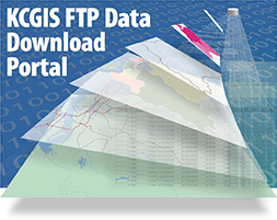
The answer is…700! Yes, it’s a trick question, because all of those layers are also in the King County GIS Open Data site. The subtraction is real though because after seven years we have retired our workhorse FTP-based GIS Data Download Portal.
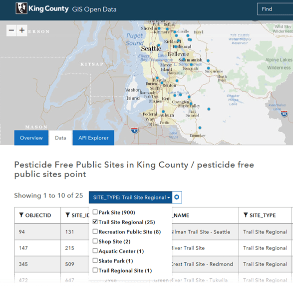
The replacement, which is an ArcGIS Hub Open Data site in our ArcGIS Online organization, has been active for two years now. From an initial posting of 107 layers, the population of layers in the site has grown to match that of the FTP site and the time was right to make a complete switchover to Open Data. And speaking of numbers, you can see a complete listing of all available layers, including update information, in our convenient one-page Open Data Catalog.
The ArcGIS Hub platform for open data sharing provides many more options for data access and consumption than the one-dimensional FTP site ever could. Users of the open data site can browse and search for layers, view metadata, inspect data tables, see visualizations of the data, and download full or partial data sets filtered by user-defined spatial extents. And it’s all available in several of the most common GIS formats that are used by GIS professionals, as well as non-specialists who perform data analysis and make their own maps with a wide variety of tools, including many that are free and/or open source. And for our FTP site users who rely on quick access to multi-layer, theme-based data collections in zipped file geodatabases and zipped folders of shapefiles, those same zipped files can be downloaded through custom links that we place on the open data layer pages (see how).
Open GIS data is about more than data downloads. The data layers in the open data site are live feature services which can be added to web maps and apps. Developers and mapmakers can access feature service URLs and source code, and any user can pop a layer into a sophisticated interactive web map with a single click (see how). From quarterly publication of GIS data on CDs and then DVDs, to free online access to data via FTP download, and now with free-and-open access to online feature services, the provision of GIS data to the community has come a long way over the last 20-odd years in the King County GIS Center. For many of those years the FTP Data Download Portal was one door. King County GIS Open Data is many doors. Welcome in!


