Kudos to Oregon State University Libraries, Oregon State University Press, and the Institute for Natural Resources on the release today of the 2018 edition of the Atlas of the Pacific Northwest.
The atlas includes more than 100 interactive maps that provide data for Oregon, Washington, and Idaho. The maps are organized in eight chapters covering regional topics:
- Agriculture & Food
- Culture & History
- Energy Resources
- Natural Hazards
- Outdoor Recreation
- Population & Housing
- Water
- Wildlife
The individual atlas maps provide quick facts about each topic, information about the data sources, a simple easy to understand legend, good navigation tools, and pop-up information for individual data points.
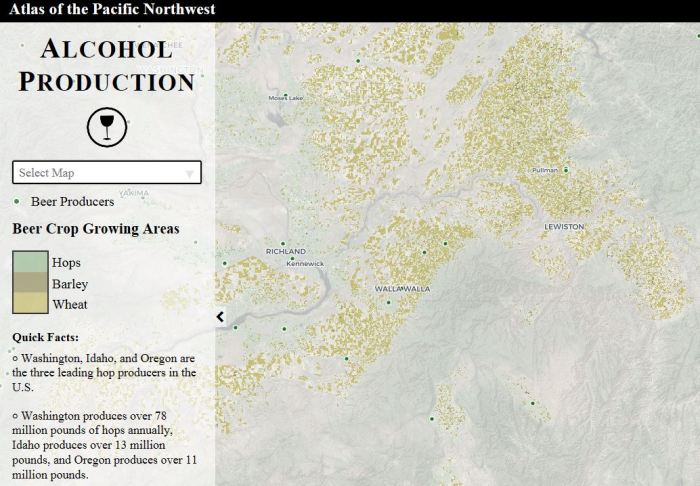
sample page from Atlas of the Pacific Northwest
The Atlas of the Pacific Northwest was first published in 1953. It went through nine editions and was a best seller for the OSU Press, but the last printed edition is now out of print. This new 2018 edition is the first to be in a fully interactive digital format. Its publication today coincides with an OSU150 celebration event at the OSU Geography Department.


Interactive Demos of the online Atlas of the Pacific Northwest (PNW) on the Hyperwall in Strand Hall 361 will be held at 10 a.m., 11 a.m. and 1 p.m. Professor Bo Zhao will provide an introduction to the Atlas of the PNW project at the 10 am demo.
LikeLike