King County’s marine research vessel, the SoundGuardian, spends much of its time on Puget Sound monitoring water quality, collecting samples to check on marine health, and maintaining marine buoys. Recently though, it went on its latest mission as part of a multi-year project to survey the King County saltwater shorelines and I was aboard. (Learn more about this modern research vessel.)
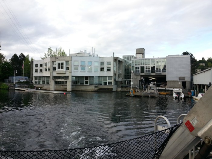
The SoundGuardian heads out from the King County Environmental Lab which is located on the south side of the Lake Washington Ship Canal near Seattle Pacific University.
The full mission team consisted of staff from the King County Water and Land Resources Division (WLRD), the Department of Permitting and Environmental Review (DPER), King County GIS, and the Washington departments of Fish and Wildlife (WDFW), and Natural Resources (WDNR). We spent a full day circumnavigating Vashon and Maury islands while collecting data on locations where human or natural activity may impact the shoreline environment. A second day of the mission was focused on the mainland shoreline of King County from Federal Way to West Point in Seattle with staff from the cities of Seattle, Normandy Park, Des Moines, and Federal Way, as well as staff from WDFW, WDNR, and the Washington Department of Ecology.
“The primary focus of this project is to monitor for new marine shoreline armoring (e.g., bulkheads, seawalls), but we are able to collect a ton of data on other shoreline features,” said project lead Kollin Higgins, an environmental scientist at WLRD. “This project provides multiple benefits but primarily helps address the needs of salmon recovery planning as well as helps the county and city jurisdictions evaluate if their Shoreline Master Plans are meeting the ‘no net loss of ecological function’ criteria.”
The team used a mobile GIS data-collection application called “Collector for ArcGIS” loaded onto an iPad which was connected to the Internet via a Verizon Wi-Fi Mobile Hotspot. Prior to sailing, King County GIS analyst Harkeerat Kang set up the means for transferring data collected in the app while out on the water to a geodatabase back at the office (a REST web service, specifically an ArcGIS feature service).

GPS track of the SoundGuardian.
As we slowly motored around Vashon and Maury islands we logged features into the geodatabase using the Collector application whenever we spotted an alteration to the shoreline. These alterations included new construction, recent repairs to retaining walls or bulkheads, clearing of vegetation on slopes, and natural landslides. Team members also took digital photos using a GPS-capable camera.
Back in the office, Mr. Higgins will import the digital photos into GIS software, sift through the data points that were collected, and compare them to data and photos collected on previous outings to verify and differentiate new activity from items that had already been logged. Any verified new constructions or manmade alterations will then be communicated to DPER staff, permits staff in affected cities, or WDFW staff who will then confirm that permits have been issued or, if not, initiate contact with the property owners to inform them of permitting requirements.

The view from the SoundGuardian’s wheelhouse.
This was the fourth shoreline alteration data collection mission in seven years as part of the ongoing project, but only the second to use this mobile data collection system. “For the first two surveys we used a combination of a handheld GPS unit to collect data and a laptop to look at baseline data,” said Mr. Higgins. “Our GPS unit’s screen is too small to have baseline data displayed in a useful or legible way, so we had to track baseline data from the laptop, but for the laptop to track where we were it had to be plugged into the wheelhouse’s antenna. We had to go back and forth to track where we were, etc. It worked, but it was clunky. The ability to consolidate both needs into the iPad and to use Collector greatly streamlined the last two surveys. It is just so much better I can’t imagine going back to using the other approach.”
“This project received funding from the EPA under an agreement with WDFW. The contents of this article do not necessarily reflect the views and policies of the EPA. Mention of trade names or commercial products does not reflect endorsement.”
Michael Jenkins is a King County GIS developer.


