
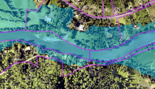
King County GIS data: Let’s do the math
Can you find the answer to this simple story problem? If the King County GIS Center has 700 layers in its FTP Data Download Portal and subtracts 700 layers from it, how many layers are left?
Can you find the answer to this simple story problem? If the King County GIS Center has 700 layers in its FTP Data Download Portal and subtracts 700 layers from it, how many layers are left?

Many of us have become numb to the latest news of firearm deaths across America. At least once almost every week there is news of a shooting in a school, workplace, church, home, or other public place. National news during the past 10 days included a school shooting in Colorado and reports of a spike…
There is a wide array of powerful free open-source tools for doing data analysis, and many of them can now handle spatial data. This post will focus on using R, specifically the tidyverse packages, as a data exploration tool for analyses that would otherwise be cumbersome in a traditional desktop GIS program. I am currently…

The American Community Survey (ACS) from the US Census Bureau helps local officials, community leaders, and businesses understand the changes taking place in their communities. It is the premier source for detailed population and housing information about our nation. ACS data is updated each year, not just during the decennial census. Esri has just made…

Cartographers and GIS analysts often have to make choices about where, within a given map space, to position points that represent real-world features. Shouldn’t be a big deal though, should it? A place is a place, a location a location. It’s just there. You know, where the house or building or parking lot, or whatever, sits on the ground! Well, it isn’t that simple.

Kudos to Oregon State University Libraries, Oregon State University Press, and the Institute for Natural Resources on the release of the 2018 edition of the Atlas of the Pacific Northwest. The atlas includes more than 100 interactive maps that provide data for Oregon, Washington, and Idaho.

“In those days Caesar Augustus issued a decree that a census should be taken of the entire Roman world. And everyone went to their own town to register.” (Luke 2) Fast forward 18 centuries and the US Constitution states: “The actual Enumeration [of every free person] shall be made…every subsequent Term of ten Years, in…

Among the fundamental skills required to be map literate, that is, to be able to read and comprehend maps, are an understanding of scale, the recognition of spatial orientation, and an appreciation of map projections. A higher-level, overarching principle of map literacy is that a single map can seldom tell a whole story, which is a point well made by Dr. Kenneth Field, Esri senior cartographic product engineer, in a recent article in Wired.

You’ve heard about vector tiles. You’ve used vector tiles in a variety of online maps, perhaps without even realizing it. But have you created your own vector tile maps?

King County GIS Training Program partner Eric Pimpler of Geospatial Training Services has authored a fascinating blog post about a building footprint dataset which Microsoft has generated from Bing aerial imagery using artificial intelligence, deep learning, and computer vision.
