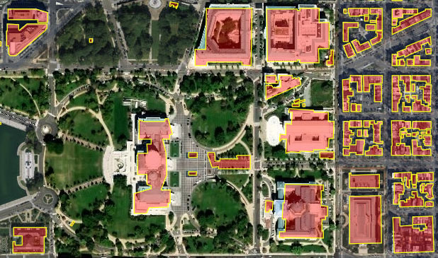
Bing computer-generated building footprints for the U.S. Capitol and vicinity.
(Esri World Imagery basemap)
King County GIS Training Program partner Eric Pimpler of Geospatial Training Services has authored a fascinating article about a building footprint dataset which Microsoft has generated from Bing aerial imagery using artificial intelligence (AI), deep learning, and computer vision. The dataset comprises footprints of 125 million structures across all 50 states. This data is available for download via GitHub free of charge in the open standard GeoJSON format.
Read Eric’s article for all the details.
Heads up! Geospatial Training Services will be teaching two specialty GIS classes at the King County GIS Center in Seattle in November. For more information and to register see:
- Introduction to Programming ArcGIS Pro with Python – November 26th and 27th
- Introduction to the ArcGIS API for Python – November 30th
Greg Babinski is KCGIS Center Marketing and Business Development Manager.


