Some of the more-interesting and rewarding projects we get to work on at the King County GIS Center are requests from other governments to help them get started on their own enterprise-wide GIS infrastructure. As anyone who has ever been involved in such work knows, this is never as simple as just purchasing software and turning on the computer. Every organization is unique and so are its requirements. There are existing business practices that need to be considered and honored. The available datasets vary from location to location. What is needed for a county of forty-thousand people probably won’t work for a county of two million, and vice-versa.
We’ve been fortunate to work on several projects like this. Not too long ago, King County GIS Center staff planned and implemented components of an enterprise Geographic Information System for Siskiyou County, California. Siskiyou, which borders Oregon, is the fifth-largest county in California by area, and is home to about 45,000 residents. Beginning in late April 2018, and continuing through October 2018, we gathered requirements, created a comprehensive evaluation and report of system needs and design, and developed a geodatabase design for core spatial datasets. We implemented Microsoft’s SQL Server, installed and configured Esri software, migrated datasets, created metadata, and deployed ArcGIS Online and various Esri apps. We capped the project by submitting a final report with recommendations for additional tasks.
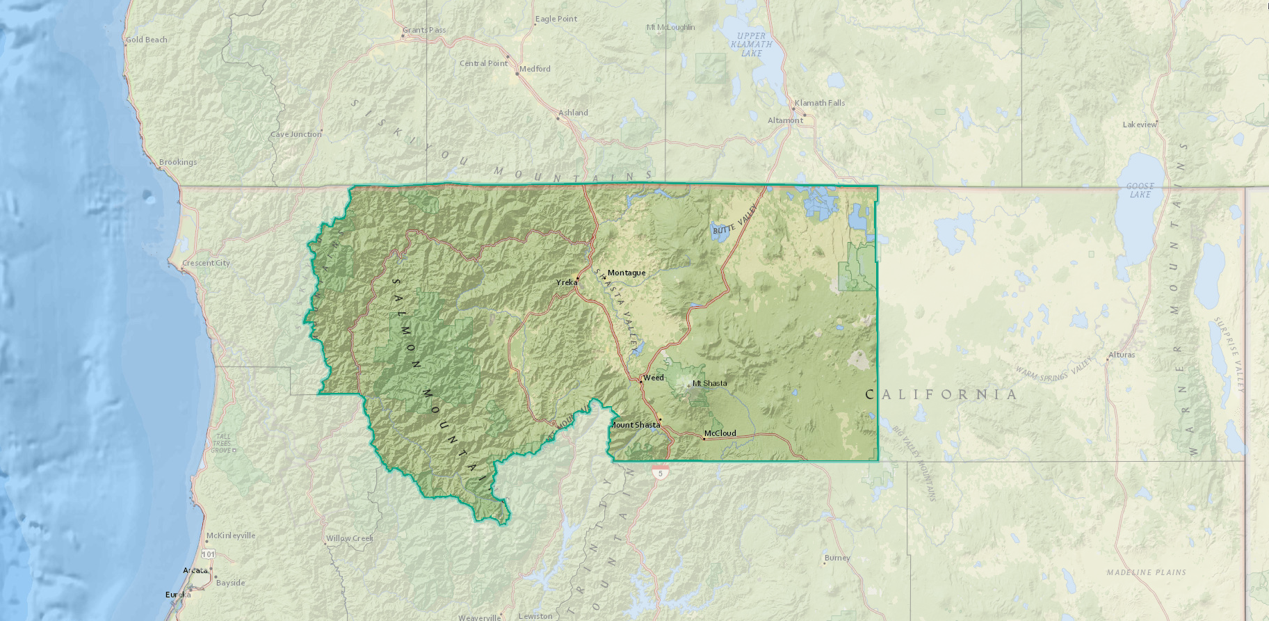
Siskiyou County, California
Sisikiyou County employee Holly Baun has many job responsibilities, but as one of the only county employees with a GIS background, co-workers and various county work groups have naturally looked to her for help and guidance with spatial data and mapping projects. As can happen in any organization that relies on an organically developed GIS capability with limited resources, frustrations often cropped up, for example, with datasets that were not standardized or properly reconciled with one another.
Although Siskiyou is a smaller county, some of its agencies preferred to “go it alone” with no outside help. But Baun knew the value that implementing an enterprise GIS could bring, and little by little she convinced the various work groups, and the county’s elected officials, to bring in some outside help.
To start the project, I paid a visit, as co-manager of the KCGIS Center’s Spatial Services group, to Siskiyou County offices in Yreka, the county seat. A very full day began with an early kick-off meeting where Baun laid out the vision and I presented the various ways GIS can be organized in municipalities. Following the kick-off, Baun and I held hour-long meetings with key staff in all departments. Upon my return to Seattle, I worked remotely with Baun to author a report,”Comprehensive Evaluation and Report of Current System Needs and Design.” County stakeholders reviewed the report before we began implementing a system that would satisfy the county’s GIS needs.

Murray Foubister via Wikimedia Commons, CC BY-SA 2.0
The project proceeded quickly but carefully from there, with KCGIS Center master analysts designing schemas based on Esri’s Local Government Information Model for key county datasets, including parcels, street centerlines, and addresses. KCGIS Center software engineer, Adam Cabrera, spent two days in Yreka to install software while mentoring key Siskiyou County IT staff. Working remotely but with the new software environment in place, other KCGIS Center staff were able to migrate existing datasets into their permanent locations, document the datasets, and establish maintenance workflows. Additional KCGIS Center staff implemented some simple Esri dashboard apps in the new ArcGIS Online environment.
Last but not least, I worked with our KCGIS Center team to document all work completed in “Final Report with Recommendations.” This report offered lessons learned, both those that are typical of GIS and Esri in general, and those that were specific to the county’s unique characteristics. We also provided options and recommendations for upcoming efforts by the county to extend their GIS implementation.
Siskiyou County now has the foundational pieces of an enterprise GIS in place, including full implementation of Esri’s ArcGIS suite of software, core spatial datasets which have been migrated to an editing and production environment, several GIS-based applications, and system documentation, including best practices. Siskiyou County’s Holly Baun has a new title: GIS Coordinator, and the county is moving forward on a solid foundation of spatial data and GIS practice.


