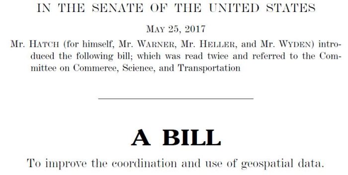
This is going to blow your mind dude, but there is bipartisan support for a current bill in the U.S. Senate. And it is related to geospatial data. The Geospatial Data Act of 2017, S. 1253, was introduced by Sens. Orrin Hatch, R-Utah, and Mark Warner, D-Virginia, and cosponsored by Sens. Ron Wyden, D-Oregon, and Dean Heller, R-Nevada.
What does S. 1253 propose to do? The bill would do many things that have long been supported by the GIS community, including several that were implemented many years ago by executive action. It would formalize the Federal Geographic Data Committee (FGDC), the National Geospatial Advisory Committee, the National Geospatial Data Infrastructure, and geospatial data standards, and it would eliminate geospatial data duplication across federal agencies. Section 8 would establish a new online GeoPlatform that would provide access to all federal agency geospatial data covered by the act. Section 9 would promote the broad availability of covered federal geospatial data and require agencies to work in partnership with state, tribal, and local agencies, universities, and the private sector to collect, integrate, maintain, preserve, and disseminate geospatial data. Section 10 would limit the use of federal funds for agencies that do not comply with the geospatial data standards developed by the FGDC.
These are all cool things that the GIS community has largely advocated for many years. But there is one section of the bill that has generated opposition within portions of the GIS community. Section 11 would require federal agencies to apply the definitions of the term “surveying and mapping,” as codified under chapter 11 of title 40, United States Code, to the term “geospatial data” as used in S. 1253.
What is the geospatial community saying about S. 1253?
- Ryan Johnston in StateScoop: GIS industry remains at odds over Geospatial Data Act.
- The National States Geographic Information Council, in its current legislative priorities, seeks bipartisan support for the act: https://www.nsgic.org/legislative-priorities#gda.
- The Association of American Geographers newsletter: The New Plot to Hijack GIS and Mapping.
- The Urban and Regional Information System (URISA) board approved a letter signed on July 5, 2017, by URISA President Tripp Corbin opposing Section 11 of S. 1253.
What do you think? Let us know your thoughts in the comments section below, and more importantly, express your individual opinions to your senators and representatives. Perhaps S. 1253, and the related H.R. 3522, will demonstrate that the GIS community can have a voice in important legislation and that a bipartisan approach can succeed in the other Washington.
Greg Babinski is KCGIS Center Marketing and Business Development Manager.


