We at both King County GIS (KCGIS) and Urban Indian Health Institute (UIHI) acknowledge that we are on the traditional land of the first people of Seattle, the Duwamish People past and present, and honor, with gratitude, the land itself and the Duwamish Tribe.
By Thomas Lawrence, Daysha Gunther, and Martell Hesketh (UIHI)
Urban Indian Health Institute, a division of the Seattle Indian Health Board (SIHB), actively works to decolonize data, for Indigenous people, by Indigenous people. UIHI recognizes that Western methods of research, evaluation, and the collection and use of data have historically excluded traditional Indigenous practices. This has led to incomplete data that misinformed medical practices, programs, and policies—all of which continue to affect the way American Indian and Alaska Native people (AI/ANs) receive care throughout the country today. UIHI is committed to strengthening community and public health by providing accurate and accessible data that reflects the needs and resiliencies of our communities.

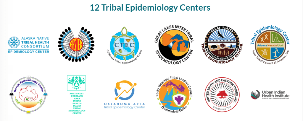
As one of 12 Tribal Epidemiology Centers (TECs) in the country—and the only one with a national scope serving Urban Indian Health Programs nationwide—UIHI services include:
• Conducting and participating in culturally rigorous research,
• Offering training on Indigenous research and evaluation,
• Providing technical assistance for other TECs and Urban Indian Health Organizations,
• Fulfilling data requests for partners and legislators, and
• Developing informational materials regarding a variety of health-related topics.
Urban Indian Health Institute strives to inform services, programs, and policies of both tribal and urban Indian health organizations, as well as local, state, and federal agencies, to build capacity and provide useful information to our communities. Partnership and collaboration are critical to advancing the health and wellbeing of American Indians and Alaska Natives. Since 2018, UIHI and the King County GIS Center (KCGIS) have worked together to create new and innovative ways to display and present data using mapping software, while also collaborating to create useful resources. Below are highlights from our collaboration.
KCGIS/UIHI Needs Assessment
Throughout the past few years, UIHI and KCGIS have built a lasting professional consultation relationship. UIHI is a public health authority tasked with the responsibility to provide accurate, clear and accessible data representing the American Indian and Alaska Native community. As such, we seek to build internal capacity by adding new data visualization tools that help us understand our population in meaningful ways.
As a team, UIHI and KCGIS staff met via Zoom to discuss annual GIS project ideas and develop a draft scope of work. UIHI’s needs included annual consultation on numerous geo-mapping projects, assistance in identifying new data visualization ideas, and training on using geo-mapping as an effective evaluation tool. To ensure UIHI’s needs were met, KCGIS staff requested we share information on current projects, including the goals and aims for each project, ideas that UIHI had for data visualization, and what we would like to learn. They also asked UIHI to identify opportunities to improve data visualization and dissemination to more effectively meet the needs of the community.
From this conversation, KCGIS followed up with UIHI staff to dive deeper into possible options. Working with the needs-assessment as a base, UIHI and KCGIS then planned and implemented numerous projects. The products and resources that resulted from these collaborative projects allowed UIHI staff and the greater Urban Indian Health Network to learn, navigate and use GIS software. Projects ranged from survey development and story map creation to resource toolkit creation.
Internship and Mentorship
Each year, UIHI invites American Indian and Alaska Native college students to participate in a summer-long internship to explore public health careers and to gain hands-on experience. UIHI interns are afforded the unique opportunity to participate in various projects related to epidemiology, suicide prevention, clinical services, public health, and Indigenous research and evaluation in urban American Indian and Alaska Native populations. The internship aims to create a space for Native students to build and share their skills and knowledge in contributing to public health. In doing so, the program works to train the next generation of public health professionals to decolonize data. Furthermore, the program strives to foster a more extensive network of Native public health workers to serve in Native communities across the nation.
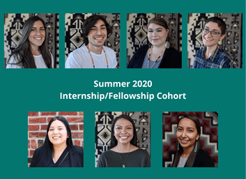
UIHI interns have the opportunity to tour labs and shadow public health professionals through UIHI’s partner organizations, including Washington State Department of Health, Fred Hutchinson Cancer Research Center, and Garden-Raised Bounty in Olympia, Washington. From these experiences, interns and fellows get to meet other public health professionals throughout the Seattle area, learn about their programs and how they contribute to the greater public health world. Most recently, the program also provided the 2020 UIHI summer interns the opportunity to meet with KCGIS staff to learn how to use GIS-mapping software on a day-to-day basis. The interns and other UIHI staff also attended the KCGIS Introduction to GIS for Equity and Social Justice half-day workshop.
COVID-19 Resource Map Project
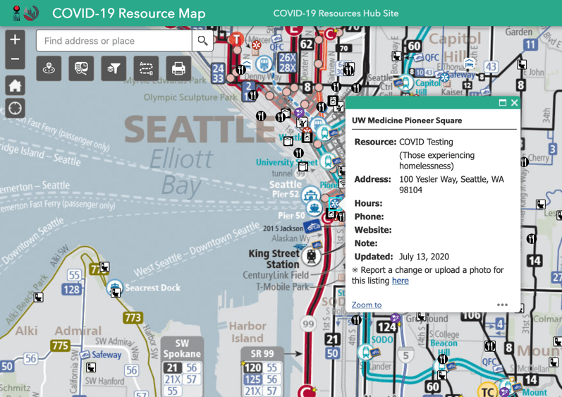
Early in the COVID-19 pandemic, the SIHB Homelessness Investments team created a list of resources and services available to American Indians and Alaska Natives experiencing homelessness. While some of these services continue, others are only available in response to COVID-19. The list includes resources such as hygiene services (e.g., open restrooms, community showers, hygiene stations), food assistance, COVID-19 testing sites, student resources, emergency shelters/isolation/quarantine locations, mobile medical vans, phone and internet connections and utility assistance. The list includes detailed information for each service such as location, hours of operation, websites, phone numbers, etc.
UIHI evaluator, Daysha Gunther (Yup’ik), translated the list of resources into an interactive map application using ArcGIS to be more accessible to the community. UIHI’s Evaluation Team expanded the resource list and added data to the map to show nearby public transit options. Over 250 resource listings are located on the map, each marked by symbols representing the resource’s category. Map users can use the tools to get and print out directions and to filter resources shown in the map. One tool called ‘Near Me’ lists all resources within a specified distance and location.
Another tool called ‘Screening’ allows the map user to draw an area of interest to see all resource listings within or near that area. Users can then generate a printable report with an image of the map area and a list of resource information details. There is also a link to an ArcGIS Survey123 input form in the splash screen which users see when the resource map is opened. A map user can then suggest resources they want to see included. Each pop-up for a mapped resource includes a link to a pre-populated Survey123 form so map users can report errors.
When the resource map was complete, UIHI presented it to their 2019/20 urban Indian organization community grantees throughout the nation. The grantees were invited to request maps for their own communities. Two expressed interest and received instructions on how to develop their list of community resources that UIHI could translate into an interactive map. The resource map for one, Oklahoma City Indian Clinic, has already been developed, while another is in the process of developing a list of resources for their community.
Role of KCGIS in Providing Support and Expertise to UIHI
Due to the relative newness of ArcGIS to UIHI, Daysha requested help from KCGIS in finding or developing a map tool to generate a list of resources with their information along with a map of their location. That is when KCGIS Developer, Yuko Caras, introduced Daysha to the ArcGIS Screening widget and helped her configure the tool. The screening tool has been beneficial among SIHB staff serving their houseless patients (also referred to as relatives).
After some use, UIHI received feedback that the inclusion of transit information would increase the tool’s helpfulness. In response, Daysha searched for and found transit data in the King County GIS Open Data site. With guidance from King County Senior Cartographer, Patrick Jankanish, she incorporated the transit data and the Metro Transit System map, helping map users find nearby transit stops and links to transit timetables.
Resource Map Impact Stories from SIHB Staff
The resource map has had a positive impact on the community:
“A client arrived at our clinic seeking supplies such as a tent and hygiene bag. He had not been able to shower for a while and had no way to get food as he only knew about one hot meal center in the area. He also did not have a phone and did not know the area well, so landmarks and street names were not much help. I asked him where he was staying, he said downtown. I was able to print a map of all the hygiene stations and food banks in a few miles radius of where he was staying [so] he did not have to keep returning to find food resources; he could just have a list with him at all times that had all the details he needed and a map showing him how to get there.”
“A patient came in to SIHB asking about access to a shelter and had mentioned that he was going to be moving to an encampment further south with a friend. He had expressed he was worried about where to find food once he was up there or how to shower. I told him about the map and printed it out with routes highlighted for him on how to access. After he had moved, he later came back in for a walk in to see about housing and we were able to get him into clean and sober housing. I personally feel that he was only comfortable coming back for assistance with housing due to the rapport from giving the hygiene kit and map as assistance. No strings-attached, immediate help can be hard to come by for the homeless community.”
But the helpfulness of mapping did not end with the resource maps.
Coast Salish Region Social Network Mapping for Indigenous Plants and Foods Educators
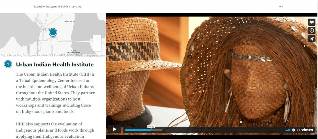
In partnership with KCGIS, UIHI worked to build a story map showing the network of Indigenous plants and foods educators in the Coast Salish region and beyond. This project is a part of a grant awarded to the Swinomish Indian Tribal Community to expand the use of an environmental sustainability curriculum based on traditional ecological knowledge (TEK) to other Northwest Coastal Native communities. Multiple organizations, both tribally affiliated and independent, have been engaged with Indigenous plants and foods work based on TEK for many years. With this work, UIHI wanted to document what the current community of practice looks like to be celebrated and shared with the community. To do this, they used a method called social network analysis (SNA), where UIHI asked participants to list who they partner with for their TEK work to capture the current community of practice. SNA data are generally displayed as a web of connections between dots and can be overlaid on a map to view the network on a geographical scale. UIHI also conducted interviews and collected photos and other media from partner organizations to gain an understanding of the impact these partnerships have had in their communities.
UIHI worked with KCGIS to transform their social network analysis into a story map and web application map that includes all the connections reported in the social network survey and the stories, quotes and other media from TEK educators’ interviews. The story map allows UIHI to highlight the impact these partnerships have had on individual communities. The web application map included query functionality that enables organizations to highlight a specific network or the partners reported by a single organization.
This project’s goal is to make all the data UIHI collected accessible to and for the community of practice—a key focus of decolonizing data. UIHI hopes that by formatting and sharing our social network data through a GIS story map, organizations and tribes will use it for their own purposes, such as grant writing and reporting. By celebrating and documenting the existing community of Indigenous plants and foods educators, UIHI can create opportunities for fostering relationships, learning and resource sharing so this work can continue to grow and thrive for future generations.
“The KCGIS Center has valued its opportunity to work with UIHI to help them put GIS to work,” said Dennis Higgins, KCGIS Project Manager. “We look forward to working with UIHI to help advance their work into the future.”
“UIHI appreciates the expertise of the KCGIS Center, they assist us in expanding innovative evaluation methods that have helped us improve data visualization and representation,” said Dr. Rose James, UIHI’s Director of Evaluation and Research.
For more information about UIHI or KCGIS, contact:
Urban Indian Health Institute: info@uihi.org
Dennis Higgins (KCGIS): dennis.higgins@kingcounty.gov


