Whether familiar with the history and personalities of mountaineering or not, cartography students of a certain age who studied mapmaking at the University of Washington would frequently hear the name of an earlier UW grad, Dee Molenaar. Any who aspired to turn their hand to depicting terrain on maps would learn from their professor of the exemplary landform maps created by Molenaar.
I had not heard Dee Molenaar’s name again for many, many years until scrolling upon a headline today which announced his passing on January 19 at the age of 101. After reading a few fascinating tributes (here and here), I wanted to refresh my recollection of his mapmaking output, which seems to receive the least attention in writings about his remarkable range of skills, exploits, and endurance.
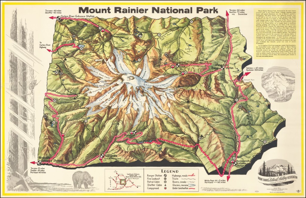
It’s not as easy as I expected it to be to find Molenaar maps online, or at least detailed views of his maps. One can catch a flavor of his work at the panorama-map.com website where there is a page that catalogs many of his maps and paintings, which one can peruse as low-resolution images. The one opportunity I’ve found to study a Molenaar map in detail is at the Barry Lawrence Ruderman, Antique Maps Inc. website, where his 1953 Mount Rainier National Park map can be examined in glorious detail down to the litho screen dots.
I can appreciate Dee Molenaar’s extraordinary life and reputation as a mountaineer, but not as keenly as his fellow mountaineers since I’m not an ice-ax-and-crampons (or heights!) person. But as someone who has wielded the tools of the map-making trade, I wanted to note the passing of this unique cartographer and express admiration for his work in my field.


