King County GIS Center is pleased to announce the upcoming soft launch of the modernized King County iMap application. Over the coming weeks, users will have the opportunity to explore the new application while the current version remains available. Following the soft launch period, the existing iMap application will be retired and the new application will become the official King County iMap.
The new application is available now at:
https://kc-imap.kingcounty.gov (new URL)
What is iMap?
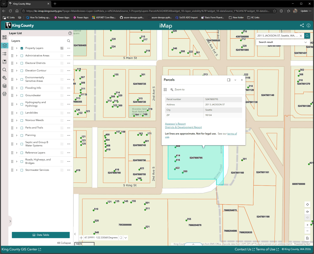
King County iMap is an interactive web mapping application that provides access to a wide variety of authoritative geographic information (GIS data) maintained by King County. Whether you’re researching property information, exploring natural resources, reviewing political boundaries, or viewing planning information, iMap provides an easy way to visualize and interact with County GIS data.
With iMap, you can:
- Search for addresses, parcel numbers, intersections, parks, schools, and other landmarks.
- View parcel and property information with links to the Assessor’s Property Report and Districts and Development Conditions Report.
- Explore dozens of GIS layers organized into thematic groups.
- Switch between multiple basemaps, including King County vector basemaps, aerial imagery, hillshade, and OpenStreetMap.
- Customize your map to display the information most relevant to your work.
- And much more!
Why a New iMap?
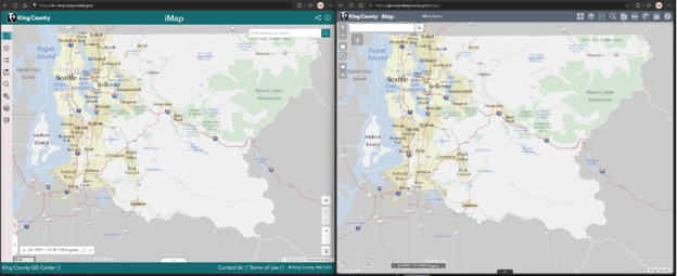
The previous iMap application was deployed on on-premise server and was built using Esri’s Web AppBuilder Developer Edition, a framework that has reached the end of its support lifecycle. To ensure the application remains secure, reliable, and maintainable, King County has rebuilt iMap with ArcGIS Experience Builder Developer Edition and hosted it in the cloud with Microsoft Azure.
While many familiar tools and workflows remain the same, the application has been modernized and rebuilt from the ground up to improve performance, usability, accessibility, and future scalability.
What’s New?
The modernized iMap includes numerous improvements while preserving the familiar functionality users rely on every day.
Modern Platform
- Built using Esri’s ArcGIS Experience Builder Developer Edition.
- Hosted in Microsoft Azure for improved reliability and scalability.
- Reduces technical debt by moving to a supported, modern platform.
- Uses ArcGIS Online Hosted Feature Layer Views for improved data management.
Improved User Experience
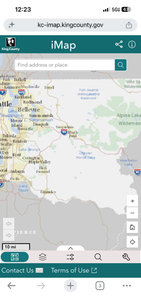
- Responsive design that works across desktop, tablet, and mobile devices.
- Cleaner, more intuitive interface.
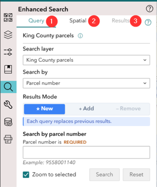
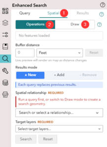
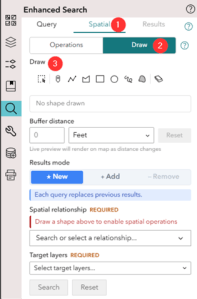
- Enhanced search capabilities with newer search functionality.
- Easier-to-follow workflows for searching, buffering, and spatial analysis.
- Improved highlighting of search results and buffer operations.
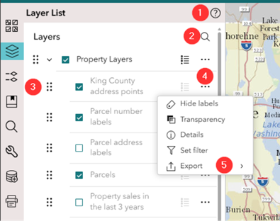
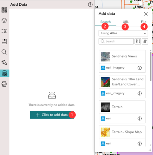
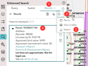
- Results are automatically added to the Layer List widget, making them easy to manage or remove.
- Reorder the layers up and down using drag handles.
- Search layer name within the Layer List widget.
- Use mini menu for layers to change layer transparency, set a filter on the layer or export the data.
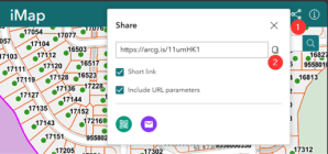
- Share links
Accessibility Improvements
Accessibility was a major focus during development. The new application includes:
- Improved support for screen readers such as Windows Narrator and NVDA.
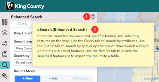
- Additional descriptive tooltips throughout the application.
- More accessible controls and navigation for users who use keyboards or screen readers to access web content
- Better guidance for first-time users.
Enhanced Mapping and Analysis
The new iMap also introduces several enhancements for GIS users, including:
- Additional layers available for querying.
- Expanded export options supporting multiple data formats.
- Export data from all selected layers instead of only a single layer.
- Easier-to-understand and use spatial operations and tools.
- Support for new URL query parameters using “#” and “?” for sharing maps and integrating with other applications.
A Familiar Experience with Modern Enhancements
One of the goals of this project was to preserve the workflows that existing users depend on while introducing improvements that make the application easier to use. Existing functionality has been retained wherever possible, with thoughtful enhancements that improve efficiency without requiring users to learn an entirely new application.
Soft Launch
The soft launch allows users to begin exploring the new application before the legacy iMap is retired. During this period, we encourage users to familiarize themselves with the updated interface and provide feedback at GISCenter@kingcounty.gov as they transition to the new platform.
After the soft launch period concludes on Wednesday, October 7th, 2026, the legacy iMap application will be retired on Friday, October 9th, 2026 and will no longer be available. The new application will become the official King County iMap.
Questions?
Please contact us (giscenter@kingcounty.gov) if you have thoughts, feedback, or questions.


