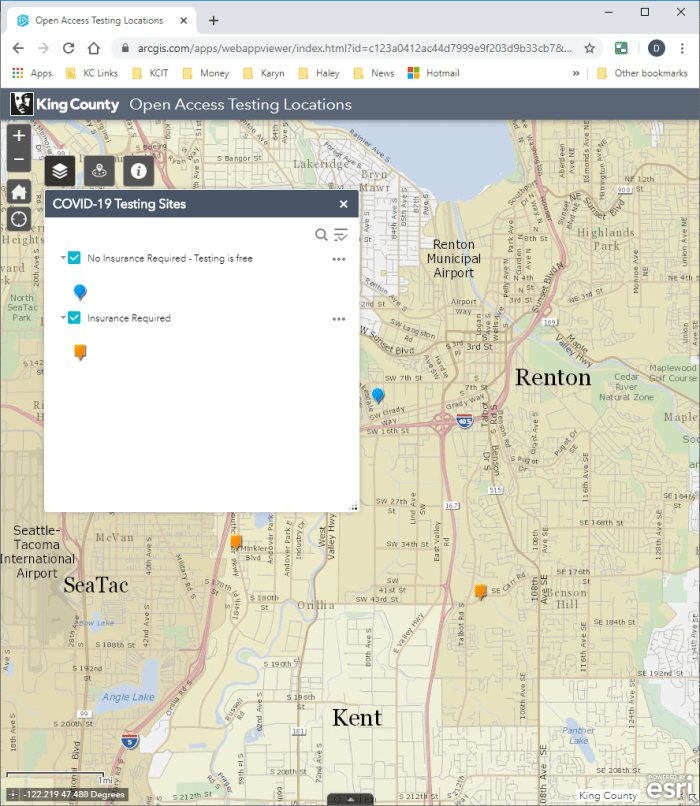
In June, Public Health — Seattle & King County requested that the King County GIS Center create a countywide web map to display open-access COVID-19 testing sites. At the time, only a text-based list of testing sites was available to the public online.
The project entailed address geocoding from a tabular list of sites provided by Public Health, creation of a web map service to enable display of the sites in an interactive web map, and finally configuring a simple, lightweight, public-facing web app for the map, all using the ArcGIS Online platform. The map displays and distinguishes between two types of testing sites, those that do not require medical insurance than those that do. Simple tools in the app allow users to search for and find testing sites in several different ways, and when a user chooses a site a driving route to the site can be generated and printed.
Since publishing the app, Public Health and the KCGIS Center have continued to work together to update the map as the data changes.
“Open Access COVID-19 Testing Locations” has been available now for several weeks and has received good reviews. Public Health has publicized the map in their newsletters, blogs, and other social media. The map is hosted in the King County ArcGIS Online Organization with a public link and is embeddable in social media and web pages. It is another example of rapidly deployable, mobile-ready map applications created by the King County GIS Center for its clients.


It’s not my first time to visit this site, i am visiting this web page dailly and obtain good facts from here all the time.
Lazio trikot
LikeLike
Pingback: GIS Day 2020 – King County GIS looks back and looks to the future | GIS & You