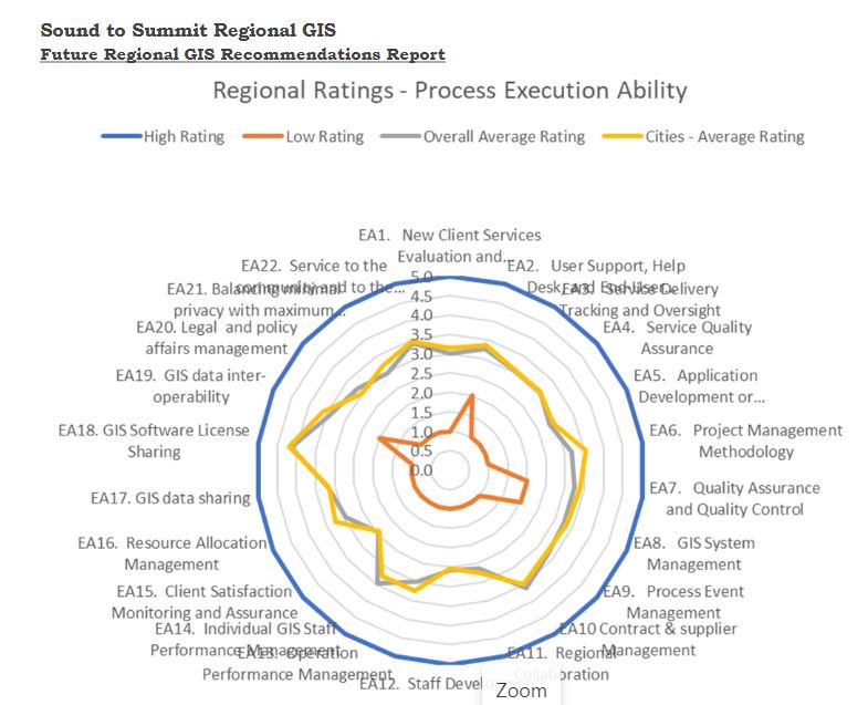
Recently the Sound to Summit Regional GIS Steering Committee approved a final report with key recommendations for pursuing a regional, collaborative GIS.
Early in 2022 agencies in the region will receive a call to action – first to attend a series of kick-off/informational sessions. These sessions will review the process that the Sound to Summit (S2S) committee executed, and the specific recommendations for going forward. After the kick-off sessions, agencies will be invited to join together to form the governance structure that will coordinate S2S Regional GIS Going forward.

S2S Regional GIS will be an opportunity to leverage the investments in GIS that dozens of agencies in our region have made already, to increase the value of GIS within individual agencies, and to help agencies that are new to GIS start to reap the benefits.
This call to action will be an invitation to you and your agency to participate in convening a regional GIS governance structure. This is the first step in standing up a collaborative regional GIS infrastructure.
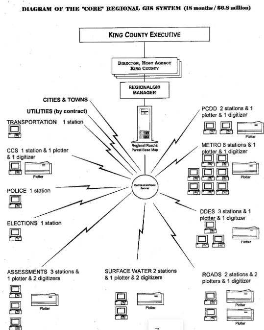
Why Sound to Summit? GIS operations leverage geographic data and science along with geospatial technology to provide business value to government agencies. Because we share common geography, we should have a common interest in the geographic data that describes us and our nearby neighbors. The concept for Sound to Summit Regional GIS began with agencies within King County. But it soon became apparent that the interests of many agencies in the region extend beyond county boundaries. And our citizens lives extend beyond political boundaries. This was the origin of the name ‘Sound to Summit’ indicating natural boundaries to the east and west, but less precise boundaries to the north and south.
Who are we? For more than three years a group of representatives from regional agencies have been studying options for a regional GIS, soliciting input from many regional agencies, and developing consensus recommendations for next steps. The Sound to Summit Regional GIS Steering Committee includes representation from large, medium, and small cities, tribes, utilities, and the county. The committee has been assisted by an Advisory Committee that includes knowledgeable GIS managers from the city, county, and state level outside the region. In addition, we have solicited input from every municipality within King County, as well as tribes, transit agencies, public utilities, and other regional agencies.

What is regional GIS? There are dozens of successful regional GIS entities across the U.S. and Canada.
What do they have in common? They share geography, plus GIS data and services. Shouldn’t we in our region also share geographic information and other components of GIS? A regional GIS seeks to implement the best feasible way to organize, maintain, and share GIS data and services within the region.
To facilitate regional collaboration, we aspire to develop GIS policies and procedures to minimize technical differences and equalize quality of data among organizations. Collaborative GIS policies and procedures will help us to share technical expertise, to enable smart communities across jurisdictional boundaries, to standardize, store, and share high-quality data, to enable GIS mutual aid and support, to build capacity through economies of scale, and to facilitate buy-in for large collaborative priority initiatives that support the entire region.
We have developed a recommended future collaborative Sound to Summit Regional GIS environment that will deliver ROI. And the regional GIS will support clear performance milestones and metrics to help validate progress.
No agency will be excluded. Once implemented every agency will be able to enhance their use and business effectiveness from GIS, increase GIS ROI, and decrease cost. Value will extend beyond jurisdictional boundaries. Citizens, businesses, academia, and non-profits will benefit from an enhanced, sustainable GIS platform for our shared Sound to Summit region.
What is not included? This is not an effort to consolidate GIS or take away from any GIS program.
What are the next steps? How can your agency participate? The next step is for you or someone from your agency to attend one of three kick-off/information meetings that will be scheduled next year. These meetings will be your opportunity to learn more details, including specific priority features, ask questions, and meet others in the region interested in participating in and helping to develop Sound to Summit Regional GIS.
Shortly after these kick-off meetings, and based on input from attendees, we will then schedule the first formal governance meeting. At the inaugural Sound to Summit Regional GIS meeting, together we will establish the governance structure that collaboratively will identify priority activities and lead the development.
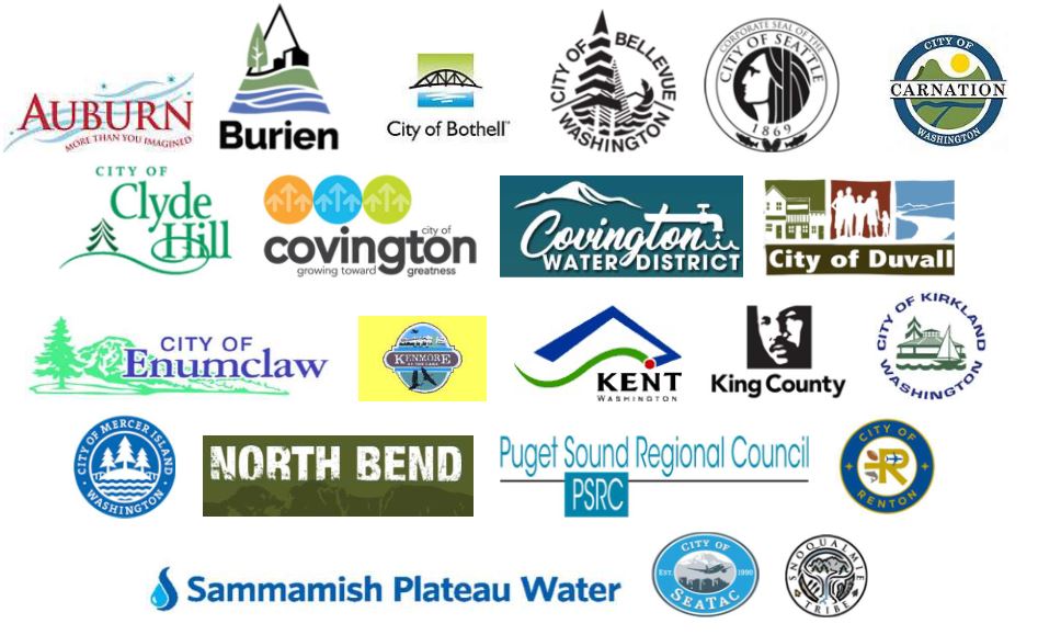
Who contributed to this effort? The Sound to Summit Regional GIS project was guided by a Steering Committee that currently includes Bellevue, Covington, Covington Water District, Enumclaw, Kent, Kirkland, King County, Mercer Island, Renton, Sammamish Plateau Water, Seattle, and the Snoqualmie Indian Tribe. The Steering Committee is supported by an Advisory Committee that includes GIS managers and academics from the States of Washington and Oregon, Skagit and Spokane Counties, Portland and Walla Walla, and the University of Washington. To help in the process, the Steering Committee conducted in-depth interview sessions with key staff from each Steering Committee agency, as well as from Auburn, Bothell, Burien, Carnation, Clyde Hill, Duval, Kenmore, North Bend, SeaTac, and Puget Sound Regional Council.